Parque Nacional Los Glaciares things to do, attractions, restaurants, events info and trip planning
Basic Info
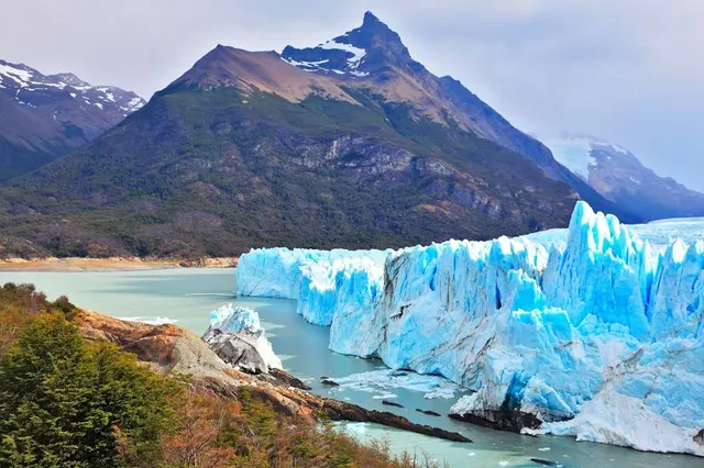
Parque Nacional Los Glaciares
Santa Cruz Province, Argentina
4.9(2.8K)
Closed

tickets
Save
spot
spot
Ratings & Description
Info
Outdoor
Adventure
Family friendly
attractions: , restaurants: , local businesses:
Phone
+54 2902 49-1005
Website
argentina.gob.ar
Open hoursSee all hours
Sat8 AM - 6 PMClosed
Plan your stay

Pet-friendly Hotels in Santa Cruz Province
Find a cozy hotel nearby and make it a full experience.

Affordable Hotels in Santa Cruz Province
Find a cozy hotel nearby and make it a full experience.

The Coolest Hotels You Haven't Heard Of (Yet)
Find a cozy hotel nearby and make it a full experience.

Trending Stays Worth the Hype in Santa Cruz Province
Find a cozy hotel nearby and make it a full experience.