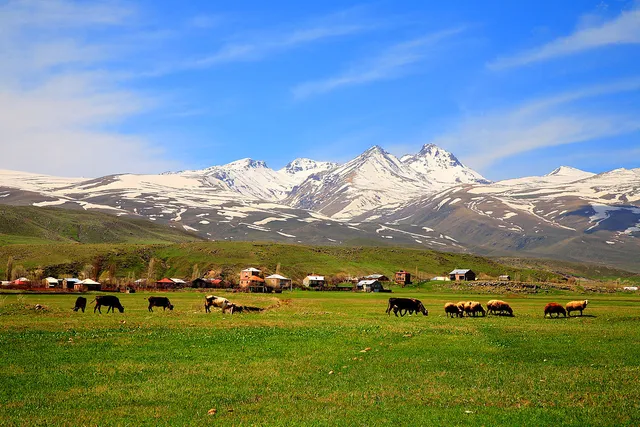
Mount Aragats, located about 46 kilometers northwest of Yerevan, Armenia's capital, is the country's highest peak, standing at 4,090 meters above sea level. This majestic mountain offers breathtaking views, diverse landscapes, and rich cultural heritage.
Best Time to Visit
The ideal time to visit Mount Aragats is from June to September, with July and August being the best months for climbing when the snow cover melts and trails are dry. For those who enjoy winter landscapes, December to February is a great time to experience the mountain's snowy beauty, though conditions can be challenging ¹.
Things to Do
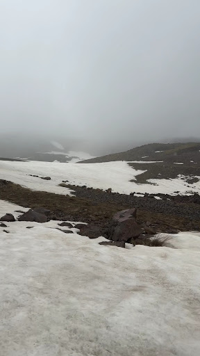
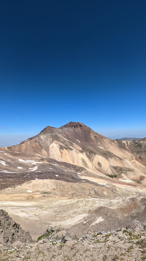
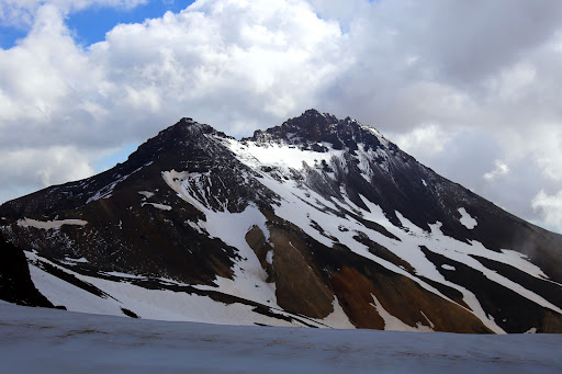
Hiking and Climbing : Explore the mountain's four peaks: Northern (4,090m), Western (3,995m), Eastern (3,908m), and Southern (3,879m). Each peak offers unique challenges and breathtaking views.
Lake Kar : A picturesque lake at 3,190 meters above sea level, serving as a popular starting point for hikes.
Amberd Fortress : A medieval fortress located on the slopes of Mount Aragats, offering stunning views and historical significance.
Byurakan Observatory : A renowned astronomical observatory situated on the mountain's slopes.
Tips and Essentials
Weather : Be prepared for changing weather conditions, especially at higher elevations.
Guided Tours : Consider hiring a local guide for a safer and more enriching experience.
Acclimatization : Plan for acclimatization days to adjust to the high altitude.
Transportation : Rent a car or hire a taxi from Yerevan for flexibility, or use public transportation options.
Additional Information
Wildlife and Flora : The mountain is home to diverse wildlife, including long-eared jerboas, hares, foxes, and wolves, as well as vibrant alpine meadows and fragrant flowers.
Cultural Significance : Mount Aragats holds historical and cultural importance, with ancient fortresses, monasteries, and rock carvings scattered...
Read moreAt first, we wanted to scale the highest (north) peak, but were discouraged by the news of a bear eating a tourist there a few weeks prior to our trip. We've decided to scale the south and west peak, the first being the lowest and most popular, because it's the easiest to get to. If you want to go to the south peak, go straight to the peak! Don't go to the pass between south and west peak first because the path from the pass is very steep and the gravel there is very slippery (that is, take the eastern path). From the south peak, it was alright to descend the steep path to the pass (if you're careful). From there, there should have been two paths to the west peak, but we found none for the reasons given below. The way up is very crumbly, don't even attempt to scale it without proper hiking boots, you'll most probably fail (scaling the south peak is IMO possible in trainers, but I wouldn't recommend it). Going up is quite exhausting, because you are constantly sliding down the crumbling rocks and rubble, also, the altitude starts to play up. However, the view from the top is amazing and the way down was the most fun I've had while climbing so far. You just lean into your boots and slide down (most of the time ankle-deep in rubble), carefully, trying not to cause a stone-avalanche. This is also the reason you won't find any path on your way up - if there ever was one (or two), all it takes is one person sliding down and you have a new path, hiding the original one. All in all, I highly recommend it. Going to the north peak would most likely require some sleeping gear, because you most likely won't be able to go from Lake Kari to the north peak and back in one day (we've spent most of the day climbing the south and west peak and...
Read moreAt 4090m(13,420 ft) above sea level, northern summit of Mount Aragats is the highest point of the Lesser Caucasus and Armenia.It is an isolated four-peaked voIcano massif in Armenia.This paradise like mountain attracts tourists in increasing numbers for exploring its four peaks. Mountain tops are always snow covered. Kari Litch (Stone Lake) is a high altitude lake nearby and is mountaineer's favourite site. With a circumference of around 200 km the Aragats massif is surrounded by Kasagh River on the east, Akhurian River on the west, Ararat plain on the south and Shirak plain on the north. Must visit...
Read more