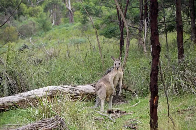
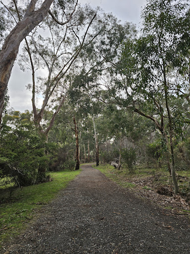
Churchill National Park, located in Melbourne's south-eastern suburbs, remains an example of the original landscape found in the region before clearing and settlement took place. Although most of the park is open regrowth woodland, there are small areas of original forest. Churchill National Park and the adjoining Lysterfield Park take in much of the southern side of the Lysterfield Hills. Both parks are home to a variety of native birds, mammals and reptiles.
Park hours
The park is open from 10:30am to 4:00pm all year.
Getting here
The main entrance to Churchill National Park is off Churchill Park Drive (Melway 82 C11) and the entrance to Lysterfield Park is from Horswood Road (Melway 108 D2).
Things to see and do
Churchill National Park offers excellent opportunities for walking, cycling, water sports and barbecuing. The Eastern Boundary Tracks are ideal for peaceful walks, jogging and cycling. Visitors to the park may be lucky enough to spot parrots, honeyeaters, wrens, thornbills, grebes, pelicans, cockatoos and even the migratory Japanese snipe. At night, you may catch a glimpse of a wallaby or a kangaroo.
Cycling
Cyclists can enjoy riding the Commonwealth Games Bike Track and associated recreational trail system, but must take note of signs restricting access for bicycles to some tracks, and must be wary of walkers on tracks at all times.
Walking
There are a number of planned walking routes below to suit all visitors:
A pleasant short walk leads from Lysterfield Lake picnic area to the dam wall. For safety reasons, please do not climb on the wall or dislodge rocks protecting it; stick to the track on top.
An 8km walk takes you around Lysterfield Lake and across the dam wall, following the Acacia Nature Trail, Casuarina Track, Lake Track and the trail through the conservation zone to Logan Park Road. From there, follow Logan Park Road or Lake Track back to the main picnic area.
For the more adventurous, a 6.4km walk (including return to the carpark) takes you up to Trig Point Lookout to enjoy spectacular 360° views of Melbourne. From the carpark at Churchill National Park, walk along Channel Track and continue along when it becomes Stonemasons Track and Lysterfield Hills Track. This track will lead you straight to the top of the hill.
Water sports
Swimming is permitted within the two swimming bays at Lysterfield Lake, however the water can be quite murky and is not patrolled, so children should be supervised at all times. Non-powered boating is permitted on the lake, except at the northern, eastern and south eastern extremities for the protection of swimmers and waterbird habitat. Sailing is permitted in monohull boats up to 5 metres long and multi-hull boats up to 4.3 metres long. There is a local sailing club which welcomes new members. Canoeing, rowing and sailboarding are also permitted, but the number of boats on the lake at any one time may be controlled. Please note that powerboats are not permitted on the lake at any time.
Facilities
At the entrance to Churchill National Park you will find barbecue facilities (gas and electric), a picnic shelter, picnic tables, toilets and a visitor information centre. At Lysterfield Lake, visitors have access to toilets and boat rigging facilities.
Visitors with limited mobility can enjoy Churchill National Park and the adjoining Lysterfield Lake Park. Both parks have ramped access and accessible toilets.
Please note there is no off-road vehicle access, and all vehicles must park in designated parking bays. There are no camping facilities at this park.
Dogs
Dogs and other pets are not permitted in the park.
Aboriginal Traditional Owners
Parks Victoria acknowledges the Aboriginal Traditional Owners of Victoria - including its parks and reserves. Through their cultural traditions, Aboriginal people maintain their connection to their ancestral lands and waters. Further information is available from Aboriginal Affairs Victoria AAV and Native Title...
Read more