Michigiwadinong: The Cup and Saucer Trail
Combined distance of all trails (includes the Adventure Trail and the Blue Trail): 10.57km
Moving time: 2h 40 min
Stopped time: 1h 38 min
Things to Bring: Water, Binoculars, Lunch, Blanket (or lightweight portable chairs)
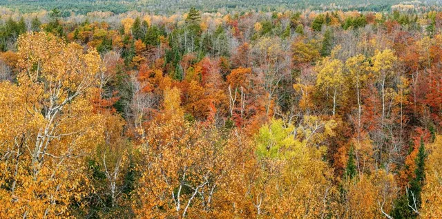
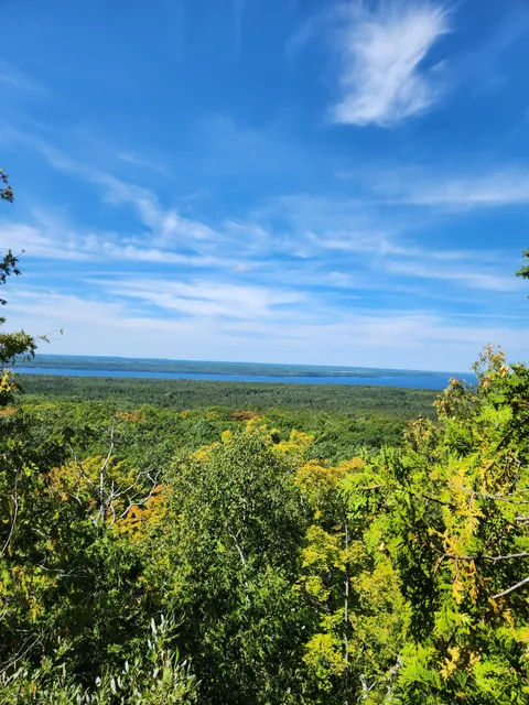
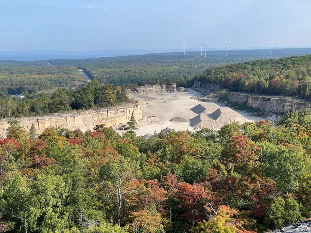
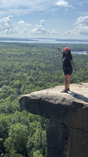
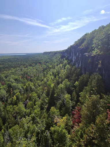
The trail is most famous for the breathtaking views from the top of the escarpment - and they are spectacular. We’ve taken in the views in both June and late-September, and both times of year have their special charms. In June the forest is lush and cooling, and wildflowers are evident along the trails. In late-September the forest is ablaze with fall colours which are particularly beautiful when viewed from on high.
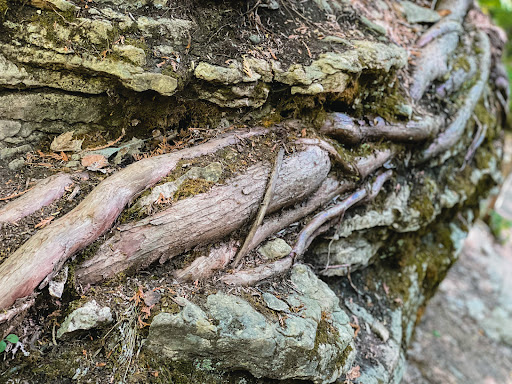
Another aspect of the trail gets less comment but is worthy of mention. The walk provides you with a chance to get up close and personal with the magnificent geological formations of the Niagara escarpment. Take in with child-like wonder close up views of hundreds of layers of rock layered like elegant brick work. Stand next to huge chunks of solid stone with deep slices carved by thousands of years of rain. Marvel at how trees sink their roots in between layers of rock, becoming one with the stone, stubbornly thriving.”
Red Trail:
The is the trail that leads from the parking lot to the famous views at the top of the escarpment. It’s a fairly easy walk, but it does require decent mobility as some portions have short but steep vertical sections that require you to clamour over a few large rocks. It takes you to the top of the bluffs and then along the cliff side offering a number of spectacular views of sweeping forests, distant lakes, and the bluffs themselves. We got a close up look at a Downy Woodpecker and a family of Grouse, as well as a number of butterfly species. Tiger Lilies were plentiful along the trailside during our mid-June visit.
The first part of the trail is a gradual ascent but a couple of spots require navigating some large rock formations and climbing a short but steep ladder. The ground also has some narrow deep crevasses in spots where water has worn through the rock, so keep young children and dogs close. The viewpoints are along steep cliff faces - mind your footing and don’t get unnecessary close to the edge.
The entire trail is shaded by healthy forest, which makes this a great walk on a hot day. The main trail is marked in red and takes you by the most popular viewpoints.
Adventure Trail:
The “Adventure Trail”, marked in yellow, is a 500 metre trail adjacent to the Red Trail. It’s a lot of fun with some challenging footwork and fascinating rock formations. You’ll find a ladder that takes you into a cave and one that takes you up onto a rocky, secluded perch. This trail should be avoided in wet conditions - it just cries out for a sprained ankle or broken wrist.
Blue Trail: We chose to walk this loop to come down from the Red Trail lookout points. We like to take this trail because it is much less travelled and provides less busy viewpoints along the top section. If you check our Google Maps for Manitoulin, we GPS marked a spot that is rarely visited with a big flat sheet of rock making for a wonderful place to sit and relax while you drink in the view. The blue trail is a bit rocky and uneven in parts, but generally it’s long stretches of very pleasant nature path through shaded trees; this is a great trail for hot summer days.
The Blue Trail is clearly marked overall, but there are two points that can be a bit confusing. You’ll run into a maintenance road (45.8420398, -82.1117584) - this is not part of the trail. Look across the maintenance road along the tree line and you’ll see blue markers (some blue trail tape as well) that mark where you are meant to re-enter the trees and connect to the ongoing trail. Past this point further down the trail seems to split as well - to our left we noticed a well-travelled foot path that had a rope hanging across it. Take note: that was not the way to go. We went right and eventually rejoined the Red Trail that took us back to the...
Read more