Der Rotenfels things to do, attractions, restaurants, events info and trip planning
Basic Info
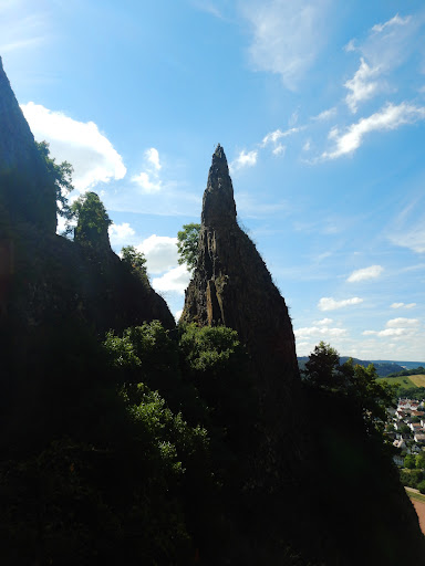
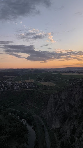
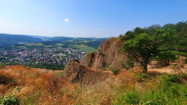
Der Rotenfels
Rotenfels, 55595 Traisen, Germany
4.8(737)
Open until 12:00 AM
Save
spot
spot
Ratings & Description
Info
Outdoor
Adventure
Scenic
Off the beaten path
attractions: Bastei - Rotenfels, restaurants: Speisegaststätte Naheblick El Greco, local businesses: Rotenfels
Phone
+49 671 33672
Website
traisen.de
Open hoursSee all hours
FriOpen 24 hoursOpen
Plan your stay

Pet-friendly Hotels in Rüdesheim
Find a cozy hotel nearby and make it a full experience.

Affordable Hotels in Rüdesheim
Find a cozy hotel nearby and make it a full experience.

The Coolest Hotels You Haven't Heard Of (Yet)
Find a cozy hotel nearby and make it a full experience.

Trending Stays Worth the Hype in Rüdesheim
Find a cozy hotel nearby and make it a full experience.
Reviews
Live events

Vineyard tour with a Mercedes Benz G-Class
Mon, Feb 16 • 12:00 PM
65347, Eltville, Germany
View details
Nearby attractions of Der Rotenfels
Bastei - Rotenfels
Bastei - Rotenfels
4.9
(14)
Open until 12:00 AM
Click for details
Nearby restaurants of Der Rotenfels
Speisegaststätte Naheblick El Greco
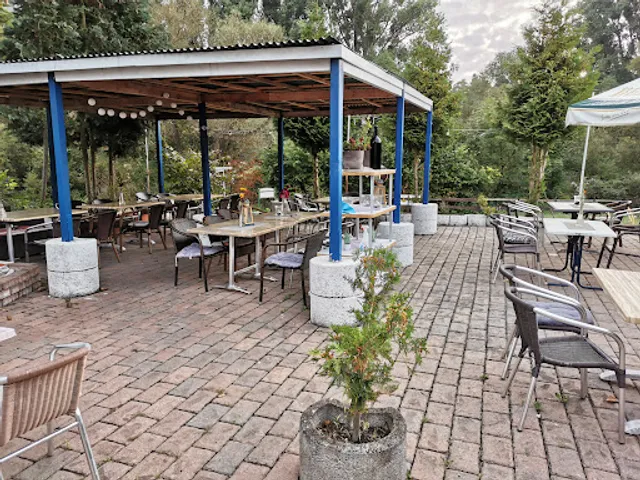
Speisegaststätte Naheblick El Greco
4.1
(132)
Closed
Click for details
Nearby local services of Der Rotenfels
Rotenfels

Rotenfels
4.9
(97)
Click for details