Français and english:
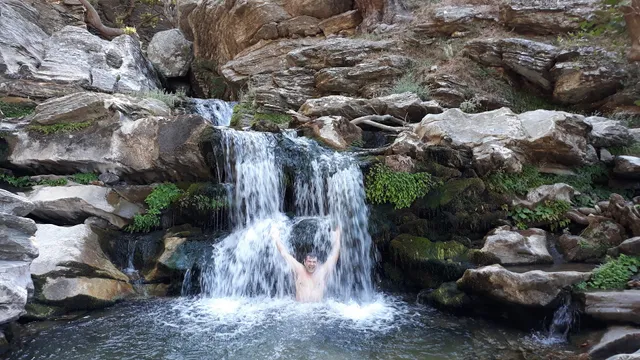
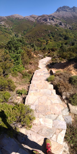
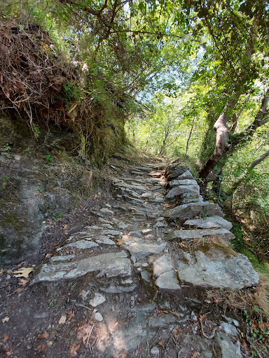
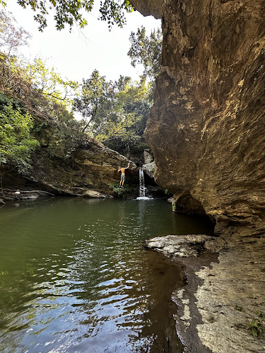
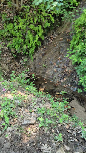
En bon marcheur et sportif, nous avons fait l'aller-retour en commençant par la montée depuis la plage de Kallianou. La meilleure partie la plus agréable, à l'ombre des platanes, est entre Lenosai et le sommet de la marche, vers la bergerie de Petrokanalo. Les bords de la rivière sont calmes et reposants, entre sous-bois, gros rochers, bassins naturels où on peut se baigner, panoramas et des gros et vieux platanes difformes mais magnifiques. Des jolis spots de camping sont dispersés le long de la rivière. Cette partie est très pentue et mieux vaut être en bonne condition et bien équipé en chaussures et pantalon (un conseil pour éviter toutes les égratignures dues aux plantes). La montée et la descente valent le coup. La partie basse entre Lenosai et la plage, par contre, est très mal indiquée et le chemin est inexistant ou quasi inexistant. Cela mériterait déblayage et débroussaillage. Nous avons préféré remonter sur la route ou chemin carrossable.
Pour tout le chemin, suivre le balisage rouge (ronds, flèches et carrés cloués aux arbres) trop sporadiques à mon goût et pas forcément aux endroits stratégiques.
As good walkers and sportsmen, we made the round trip hike starting with the climb from the beach of Kallianou. The best and most enjoyable part, in the shade of the plane trees, is between Lenosai and the top of the walk, around the Petrokanalo sheepfold. The banks of the river are calm and relaxing, between undergrowth, big rocks, natural pools where you can swim, scenic views and large and old plane trees misshapen but beautiful. Pretty camping spots are scattered along the river. This part is very steep and better to be in good condition and well equipped in shoes and pants (a tip to avoid any scratches due to plants). The ascent and descent are worth it. The lower part between Lenosai and the beach, on the other hand, is very badly indicated and the path is non-existent or almost nonexistent. This deserves clearing and strimming. We preferred to go back up on the road or passable track.
For all the way, follow the red markings (painted rounds, arrows and squares nailed to trees) too sporadic and not necessarily in strategic places...
Read more