The biotopo is one of the best places in this area to experience the cloud forest. The preserve covers a large part of an extremely steep mountain covered in verdant old-growth forest. The biodiversity of the trees, moss, ferns, bromeliads, and air plants here is incredible. The preserve has two trails: the shorter one (“Los Helechos”) is 2 km or about 1 hour round-trip, and the longer (“Los Musgos”) is 4 km or 2 hours round-trip. Both trails start with a steep climb of numerous switchbacks before leveling off and then descending back down to the visitor center. The trails are well-designed and covered in gravel to keep them from getting too muddy, but proper shoes with some grip are still recommended. At the very end of both trails there are two large pools fed by a waterfall where you can swim, so pack a swimsuit (there are changing rooms and restrooms by the pools). The longer trail also features a short turnoff to a viewpoint with stunning views of the valley below, as well as a massive old tree called the “Grandfather Tree”. Staff informed us that the best place to see quetzales in the springtime is around this tree, at the highest part of the trail, since the quetzales spend more time high up on the mountain before breeding, raising their young, and then migrating down the mountain in the summer. You don’t have to go far to see birds, however - we saw dozens of warblers and other songbirds on the shorter trail closer to the visitor center. The reserve also features a display of local orchids, as well as secure...
Read moreThe area to which the visitors are allowed is really quite limited. Maybe for a good reason:) but like this it is really difficult to spot quetzales... actually any birds at all.. I wasnt very lucky with the weather and maybe this kind of influenced my overall rating. And maybe the fact that foreiners are charched 4 times more (40quetzales) than the visitors from the Central American countries (10 quetzales). And it would have costed me double to camp there (20) than my friend (10)... but the trails are well kept, the walk is nice.and you get to get to a waterfall. Quite an easy walk on very well marked.trail. no challenge for serious hikers🙄 if you are in that area, you might consider walking to Salto de Chilasco, the higest waterfall in...
Read moreCARACTERÍSTICAS DEL QUETZAL, AVE SÍMBOLO DE GUATEMALA.
El quetzal resplandeciente posee un plumaje verde iridiscente que puede cambiar de color con la presencia del sol y puede tener reflejos de color oro y azul-violeta. Su pico es de color amarillo brillante. Las hembras se llaman Quetzalí y no tienen una larga cola, pero si tienen colores verdes, rojos y azulados, además de que su pico es de color negro.
Es el ave nacional de Guatemala desde 1871. Tiene también un papel importante en los mitos de la región. En las civilizaciones precolombinas de Mesoamérica, era considerada un ave divina asociada a Quetzalcoatl, la deidad "serpiente emplumada". Los antiguos mexicas y mayas vieron el quetzal como el "dios del aire" y como un símbolo de la bondad y la luz, y sus plumas de cola verde iridiscentes fueron veneradas como símbolos para el crecimiento de las plantas en la primavera. Los gobernantes de Mesoamérica y algunos otros rangos de la nobleza, llevaban tocados de plumas del quetzal como símbolo de su relación con Quetzalcóatl. Como era un crimen matar a un quetzal, el ave fue únicamente capturado para sacarle algunas plumas y luego puesto en libertad. En varios idiomas mesoamericanos, el término para quetzal también tiene el significado de "sagrado", "precioso" o "erigido.
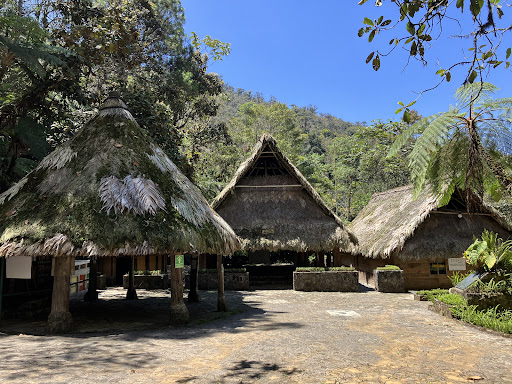
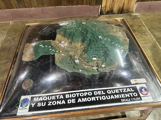
Se distribuye desde el oriente del Istmo de Tehuantepec en el sur de México hasta el oeste de Panamá, incluidos la zona centro de Guatemala, en todo Honduras, Oriente de El Salvador, norte de Nicaragua y centro de Costa Rica En su área de distribución vive únicamente en bosques nubosos montanos entre 1000 y 3000 m s. n. m.
📸 Marvin W. Laynes #fotografiasparaelalma #birdsphotography
Publicado en la página de Facebook de la Dirección Departamental de Educación...
Read more