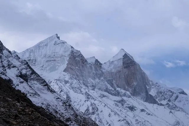
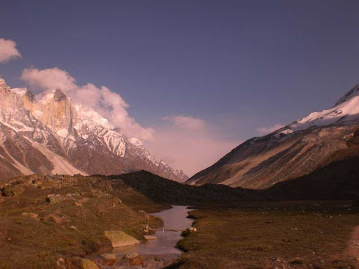
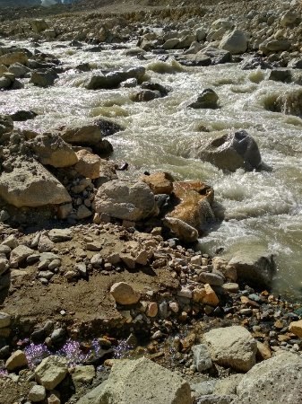
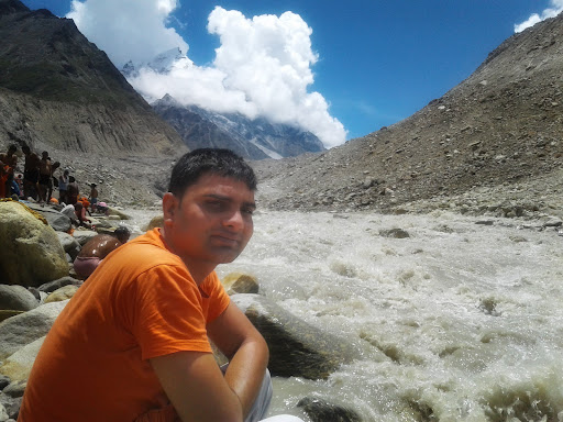
Gomukh, also known as "Gaumukh" or "Gomukhi" is the terminus or snout of the Gangotri Glacier and the source of the Bhagirathi River, one of the primary headstreams of the Ganges River. .......The place is situated at a height of 13,200 ft (4,023 m) in Uttarkashi district in the state of Uttarakhand, India....... It is one of the largest in the Himalayas with an estimated volume of over 27 cubic kilometers. It is a popular Hindu pilgrimage site, along with Gangotri, as well as trekking destination.......m On 26 July 2016, following heavy rains in Uttarakhand, it was reported that the front end of Gomukh was no more, as a large chunk of the glacier had collapsed and was washed away... In 2013, due to cloud burst in Uttarakhand, huge cracks had emerged on the glacier.......Gomukh, "Mouth of a Cow", the snout of the glacier along the river...The word "Gomukh/Gaumukh" literally means "Mouth of a Cow." According to some sayings, earlier the snout exactly looked like the "Mouth of a Cow.".......A small shrine at Gaumukh, Gangotri glacier......Gomukh is mentioned in the Puranas. ....It is said there that searching a lost sheep a shepherd boy reached near a glacier in Gangotri, the snout of which exactly looked like the mouth of a cow, and thus it got its name 'Gomukh'..... From then many saints, holy travelers, as well as religious people went there to worship the place.....Gomukh, terminus of the Gangotri glacier. The Bhagirathi peaks rise in the background.......Gomukh is 18 km from Gangotri in the foot hills of Bhagirathi at a height of 4255m. It is the snout of the Gangotri Glacier.,....... The Bhagirathi river here is pretty speedy. Around the snout, nature presents a wild topography..... There are boulders scattered here and there with some pieces of broken snow, along with the hard clayey snow of the glacier. The Gomukh snout is rapidly moving backwards. .....According to the modern research the snout has moved 1 km in just 70 years......The first and foremost thing for Gomukh trek is that you must have permission from (D.F.O.) District forest officer, Uttarkashi. Only 150 permits are issued per day, permission can be taken via fax also. The trail to Gomukh begins from Gangotri, about 18 km (11.2 mi) from Gomukh........ It was heavily damaged by rockslides by the 2013 North Indian Floods as was road access to Gangotri. 9 km ahead of Gangotri is Chirbasa, the abode of Chir trees. After 3 km of Chirbasa comes the dangerous Gila Pahar, the place well known for its landslides even prior to the 2013 destruction of much of the trail here; near-sheer cliffs down to the river must now be traversed. Here the Bharals, a type of mountain antelope are sometimes seen. .....The Bharals are found above the altitude of 10,000 ft. Only 4 km from here is Bhujbasa, the only night halting place on the way with buildings. .....One can stay at the GMVN Bunglow, or at the Lalbaba's Ashram or at Ram Baba's ashram; both ashram charge Rs 300 for a day that includes lodging and food. ....After trekking 41/2km from Bhujbasa, one reaches Gomukh, the snout of the Gangotri Glacier.A little before Gomukh, the majestic view of Mt. Shivling welcomes the trekkers to the place.....m On the trail no horses are allowed, so one must take preparations to walk on foot. The trek to Tapovanan and Nandanvan starts from here.....The route after 'Bhojbasa' can be quite difficult, more so since the 2013 floods. One has to cross a boulder zone to reach the Gomukh snout. The trek beyond Gomukh is quite difficult...... Crossing the glacier & going towards Tapovan has become quite dangerous nowadays (because of the landslides). There is no track and one must have a guide and should be prepared to face any type of accident which can even be a life-threatening one. The last climb to reach Tapovan is very stiff, within 2 km a climb of around 1500 foot and is quite a challenging...
Read more