Kamet is the second highest mountain in the Garhwal region of Uttarakhand, India, after Nanda Devi. It lies in the Chamoli District of Uttarakhand. Its appearance resembles a giant pyramid topped by a flat summit area with two peaks. Due to its position near the Tibetan Plateau, Kamet is very remote and not as accessible as some Himalayan peaks. It also receives a great deal of wind from the Plateau. However, by modern standards, it is a relatively straightforward ascent for such a high mountain. Early explorers of the region faced long approach marches of around 200 miles (321.9 km) from Ranikhet through dense mountain forest; access is easier today.
While attempts to climb Kamet began in 1855, the first ascent was not made until 1931 by Frank Smythe, Eric Shipton, R.L. Holdsworth, Dr Raymond Greene, the expedition's doctor, Bill Birnie and Lewa Sherpa, members of a British expedition. Kamet was the first summit over 25,000 ft (7,620 m) to be climbed, and was the highest summit reached until the first ascent of Nanda Devi five years later. (However, far higher non-summit altitudes had been reached on the north side of Mount Everest in the 1920s.)
The standard route begins from the East Kamet (or Purbi Kamet) Glacier, ascending via Meade's Col (c. 7,100m/23,300 ft), the saddle between Kamet and its northern outlier Abi Gamin. From Meade's Col the route ascends the northeast edge of the north face. The ascent to Meade's col involves steep gullies, a rock wall, and several glacier climbs. Five camps are usually placed en route. The final ascent to the summit involves steep snow, possibly icy
The West (Pachmi or Paschimi) Kamet Glacier, the East (Purbi or Purva) Kamet Glacier and the Raikana Glacier systems surround Kamet. The branches of the West Kamet Glacier head on the western slopes of Kamet, Abi Gamin, and Mukut Parbat. The East Kamet Glacier flows from the eastern side of Kamet and Mana. The Raikhana glacier originates on the east side of Meade's Col saddle, flows east of Abi Gamin, and unites with the East Kamet Glacier. The West Kamet Glacier drains into the Saraswati River while the East Kamet Glacier feeds the Dhauliganga River; both rivers are tributaries of the Alaknanda River, the major river of the...
Read more
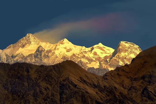
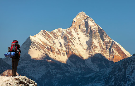
Kamet, towering at an elevation of 7,756 meters (25,446 feet), stands as the second-highest peak in the Garhwal Himalayas of Uttarakhand, India. Nestled amidst the breathtaking landscape of the Himalayas, Kamet is a prominent feature of the region's majestic skyline, captivating the imagination of mountaineers and adventurers from around the world.
Part of the Zaskar Range, Kamet offers a formidable challenge to climbers with its steep slopes, treacherous terrain, and unpredictable weather conditions. Despite its challenges, Kamet has attracted climbers seeking to conquer its summit since the early 20th century.
The first successful ascent of Kamet was achieved in 1931 by a British team led by Frank Smythe, Eric Shipton, and R.L. Holdsworth. Since then, numerous expeditions have been undertaken to summit Kamet, adding to its allure as a coveted achievement in the mountaineering world.
Beyond its mountaineering significance, Kamet holds cultural and spiritual importance for the local communities. It is revered as a sacred mountain, with legends and folklore surrounding its towering peaks.
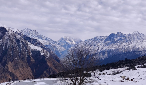
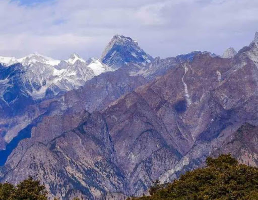
For adventurers and nature enthusiasts, trekking in the vicinity of Kamet offers an opportunity to experience the raw beauty of the Himalayas up close. The region's pristine landscapes, alpine meadows, and glacial lakes provide a stunning backdrop for trekkers seeking adventure amidst the towering peaks.
In essence, Kamet stands as a symbol of the Himalayan spirit, beckoning adventurers to test their limits and embrace the awe-inspiring beauty of the world's highest...
Read moreKamet (Hindi: कामेत) is the second highest mountain in the Garhwal region of Uttarakhand, India, after Nanda Devi. It lies in the Chamoli District of Uttarakhand. Its appearance resembles a giant pyramid topped by a flat summit area with two peaks.
Due to its position near the Tibetan Plateau, Kamet is remote and not as accessible as some Himalayan peaks. It also receives a great deal of wind from the Plateau. However, by modern standards, it is a relatively straightforward ascent for such a high mountain. Early explorers of the region faced long approach marches of around 200 miles (321.9 km) from Ranikhet through dense mountain forest; access is easier today.
While attempts to climb Kamet began in 1855, the first ascent was not made until 1931 by Frank Smythe, Eric Shipton, R.L. Holdsworth and Lewa Sherpa, members of a British expedition. Kamet was the first summit over 25,000 ft (7,620 m) to be climbed, and was the highest summit reached until the first ascent of Nanda Devi five years later. (However, far higher non-summit altitudes had been reached on the north side of Mount Everest in the 1920s.)
The standard route begins from the East Kamet (or Purbi Kamet) Glacier, ascending via Meade's Col (c. 7,100m/23,300 ft), the saddle between Kamet and its northern outlier Abi Gamin. From Meade's Col the route ascends the northeast edge of the north face. The ascent to Meade's col involves steep gullies, a rock wall, and several glacier climbs. Five camps are usually placed en route. The final ascent to the summit involves steep snow,...
Read more