Lut Çölü, güneybatı İran'da geniş bir tuz çölüdür. İran iklim olarak Batı Afrika'daki Yeşil Burun Adaları'ndan başlayıp Moğolistan üzerinden Çin'in başkenti Pekin yakınlarına kadar uzanan Afro-Asyatik çöller kuşağının bir paçasıdır. Kum tepeleri Lut'un merkezinin güneyindedir. Bu kum tepelerinin yüksekliği 480 metreye kadardır. Kum tepelerine ulaşmak için, 4WD ve deneyimli bir rehberle bir tur atmanız gerekir. Rüzgar, aynı zamanda, sert kayalık fosilleri soyunmakta ve bu da, alanın yaklaşık% 12'sinde kum taşlı taşlarla geniş taşlı çöl parkeleri bırakmaktadır. Geniş, siyah taşlı bir çöl, ana bölgenin kuzeybatısında bulunan bazaltik Gandom Beryan platosunu kaplar. Doğu Lut'daki taşlı çöller, moloz bir kaplama olarak, ana kayayı kesen ve komşu tepelerin ayağından hafifçe eğimli kaya platformları olan geniş pediplainler olarak kaplanmıştır.
Iran is climatically part of the Afro-Asian belt of deserts, which stretches from the Cape Verde islands off West Africa all the way to Mongolia near Beijing, China. The patchy, elongated, light-colored feature in the foreground (parallel to the mountain range) is the northernmost of the Dasht dry lakes that stretch southward 300 kilometers (190 mi). In near-tropical deserts, elevated areas capture most precipitation. As a result, the desert is largely an abiotic zone[further explanation needed
iran's geography consists of a plateau surrounded by mountains and divided into drainage basins. Dasht-e Loot is one of the largest of these desert basins, 480 kilometers (300 mi) long and 320 kilometers (200 mi) wide, and is considered to be one of the driest places on Earth.
The area of the desert is about 51,800 square kilometres (20,000 sq mi).The other large basin is the Dasht-e Kavir. During the spring wet season, water briefly flows down from the Kerman mountains, but it soon dries up, leaving behind only rocks, sand, and salt.
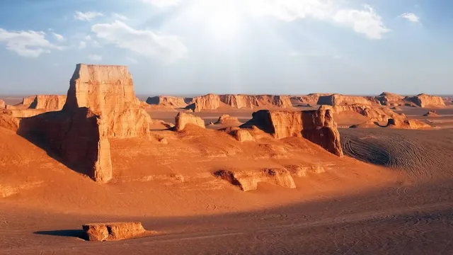
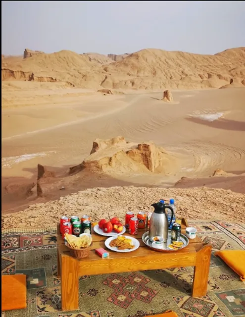
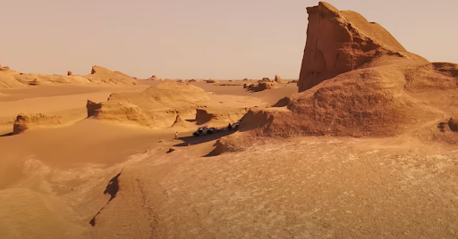
The eastern part of Dasht-e Loot is a low plateau covered with salt flats. In contrast, the center has been sculpted by the wind into a series of parallel ridges and furrows, extending over 150 km (93 mi) and reaching 75 metres (246 ft) in height. This area is also riddled with ravines and sinkholes. The southeast is a vast expanse of sand, like a Saharan erg, with dunes 300 metres (980 ft) high, among the tallest in the world. The Sand dunes are situated in the south of central Lut. The height of these sand dunes is up to 480 meters. In order to reach the dunes, you'll need to do a tour with a 4WD and experienced guide.
The wind also strips hard rocky outcrops bare of soil, which leaves extensive stony desert pavements (hamada) with sand-blasted faceted stones (ventifacts) across about 12% of the area. An extensive, black stony desert covers the basaltic Gandom Beryan plateau in the northwest of the core zone. The stony deserts in eastern Lut cover, as a rubbly veneer, extensive pediplains, which are rock platforms that truncate bedrock and gently slope away from the foot of...
Read more