HTML SitemapExplore

Kuh-e Dinar — Attraction in Padena-ye Vosta RD

Name
Kuh-e Dinar
Description
Dena is the name for a sub-range within the Zagros Mountains, Iran. Mount Dena, with 80 km length and 15 km average width, is situated on the boundary of the Isfahan, Kohgiluyeh and Boyer-Ahmad and Chaharmahal and Bakhtiari Provinces of Iran. Mount Dena has more than 40 peaks higher than 4,000 metres.
Nearby attractions
قله قاش مستان (بیژن 3)
XC2P+MC9, Khafr, Isfahan Province, Iran
Nearby restaurants
Nearby local services
Nearby hotels
Related posts
Keywords
Kuh-e Dinar tourism.Kuh-e Dinar hotels.Kuh-e Dinar bed and breakfast. flights to Kuh-e Dinar.Kuh-e Dinar attractions.Kuh-e Dinar restaurants.Kuh-e Dinar local services.Kuh-e Dinar travel.Kuh-e Dinar travel guide.Kuh-e Dinar travel blog.Kuh-e Dinar pictures.Kuh-e Dinar photos.Kuh-e Dinar travel tips.Kuh-e Dinar maps.Kuh-e Dinar things to do.
Kuh-e Dinar things to do, attractions, restaurants, events info and trip planning
Kuh-e Dinar
IranIsfahan ProvincePadena-ye Vosta RDKuh-e Dinar

Basic Info

Kuh-e Dinar

Iran
4.6(47)
Open 24 hours
Save
spot

Ratings & Description

Info

Dena is the name for a sub-range within the Zagros Mountains, Iran. Mount Dena, with 80 km length and 15 km average width, is situated on the boundary of the Isfahan, Kohgiluyeh and Boyer-Ahmad and Chaharmahal and Bakhtiari Provinces of Iran. Mount Dena has more than 40 peaks higher than 4,000 metres.

Outdoor
Adventure
Scenic
Off the beaten path
attractions: قله قاش مستان (بیژن 3), restaurants: , local businesses:
logoLearn more insights from Wanderboat AI.

Plan your stay

hotel
Pet-friendly Hotels in Padena-ye Vosta RD
Find a cozy hotel nearby and make it a full experience.
hotel
Affordable Hotels in Padena-ye Vosta RD
Find a cozy hotel nearby and make it a full experience.
hotel
The Coolest Hotels You Haven't Heard Of (Yet)
Find a cozy hotel nearby and make it a full experience.
hotel
Trending Stays Worth the Hype in Padena-ye Vosta RD
Find a cozy hotel nearby and make it a full experience.

Reviews

Nearby attractions of Kuh-e Dinar

قله قاش مستان (بیژن 3)

قله قاش مستان (بیژن 3)

قله قاش مستان (بیژن 3)

5.0

(12)

Open 24 hours
Click for details
Get the Appoverlay
Get the AppOne tap to find yournext favorite spots!
Wanderboat LogoWanderboat

Your everyday Al companion for getaway ideas

CompanyAbout Us
InformationAI Trip PlannerSitemap
SocialXInstagramTiktokLinkedin
LegalTerms of ServicePrivacy Policy

Get the app

© 2025 Wanderboat. All rights reserved.

Posts

Mj EsmiMj Esmi
High altitude DENA mountains Up 4000 m
samad alizadehsamad alizadeh
منطقه حفاظت شده دنا سمت روستای میمند یاسوج
hotel
Find your stay

Pet-friendly Hotels in Padena-ye Vosta RD

Find a cozy hotel nearby and make it a full experience.

High altitude DENA mountains Up 4000 m
Mj Esmi

Mj Esmi

hotel
Find your stay

Affordable Hotels in Padena-ye Vosta RD

Find a cozy hotel nearby and make it a full experience.

Get the Appoverlay
Get the AppOne tap to find yournext favorite spots!
منطقه حفاظت شده دنا سمت روستای میمند یاسوج
samad alizadeh

samad alizadeh

hotel
Find your stay

The Coolest Hotels You Haven't Heard Of (Yet)

Find a cozy hotel nearby and make it a full experience.

hotel
Find your stay

Trending Stays Worth the Hype in Padena-ye Vosta RD

Find a cozy hotel nearby and make it a full experience.

create-post
Turn your ideas into a post and inspire others!
Create

Reviews of Kuh-e Dinar

4.6
(47)
avatar
5.0
2y

"Dena Peak or the Dena Mountain Range is considered the tallest and largest subrange of the Zagros Mountain Range, with an approximate length of 90 kilometers. The name of this mountain range is derived from the ancient city of Dehnar (Deh Anar) located in the southwestern foothills of the mountain, where the ruins of this city are visible near the villages of Khungah and Dasht-e Riz in the Dena County.

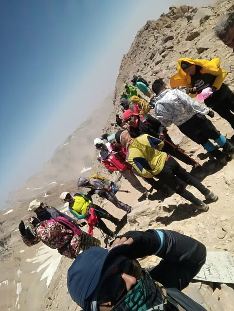
The Dena Mountain Range is located in the provinces of Isfahan, Kohgiluyeh and Boyer-Ahmad, and it is one of the 1,515 prominent mountain peaks worldwide. The Dena Mountain Range has 52 peaks over 4,000 meters in elevation, and the majority of the highest peaks over 4,000 meters in Iran belong to this mountain range.

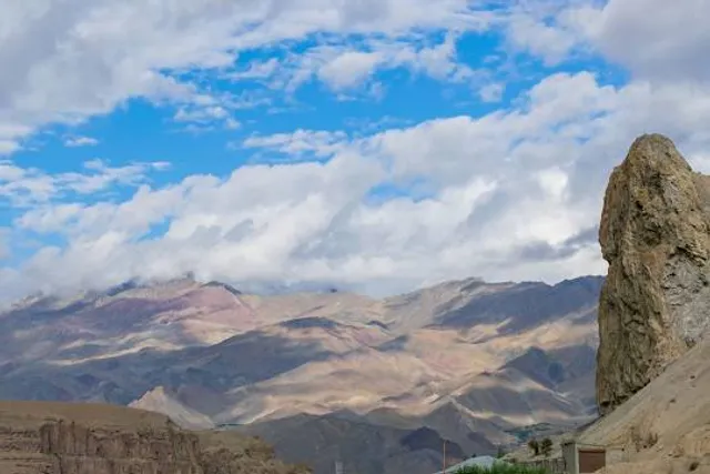
Contrary to common belief, Dena is not a single peak; rather, it is a mountain range in the Zagros region that stretches from northwest to southeast, straddling the three provinces of Isfahan, Kohgiluyeh and Boyer-Ahmad, and Chaharmahal and Bakhtiari. It is divided into three main ridges and one subsidiary ridge, separated by the three passes of Bijan, Morgol-e Gharbi, and Pootak.

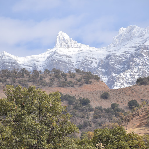
Dena starts approximately 20 kilometers east of Yasuj and continues up to 70 kilometers northwest in the Isfahan province. The highest peak of the Dena Mountain Range is Mount Bijan 3 (Qashmastan) on the border of the Paden-e Samiram area and the city of Sisakht, with an elevation of 4,459 meters, located about 35 kilometers northwest of Yasuj. The Paden-e Samiram area and the city of Sisakht are situated at the base of this mountain. Due to its considerable length and varying elevations, annual precipitation in this mountain ranges from 600 to 1800 millimeters, giving rise to numerous rivers, including Bashar, Kharsan, Rigan, Marbar, Mehryan, Kooh Gol, Diyashm, Siriz, Tizab, and Dezgard, among others.

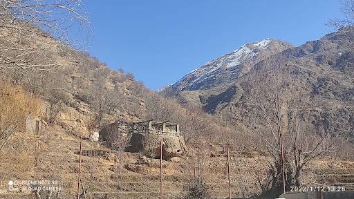
The eastern boundary of the Dena Protected Area begins north of the city of Sisakht, which serves as the administrative center of Dena County. Some of the important environmental protection outposts include Kharehidoon, Koreh, Ab Sepah, and Mimanad. The Dena Protected Area, with an area of approximately 93,821 hectares, is located in the southwestern part of the country in the Kohgiluyeh and Boyer-Ahmad province, with geographical coordinates of E5121 latitude and N3057 longitude.

On the other hand, the Dena region has numerous valleys, many of which are filled with small and large springs. Many of these springs emerge from beneath the snow, flow down from the steep slopes of Dena, and eventually join to form the cool, sweet, and clear rivers of Bashar...

   Read more
avatar
5.0
4y

کهگیلویه و بویراحمد منطقه ناهمواری است.حدود سه چهارم مساحت منطقه از ارتفاعات و تپه ماهورها تشکیل شده است. دشتها تنها یک چهارم مساحت را تشکیل می دهند. به گزارش خبرنگار خبرگزاری دانشجویان ايران(ايسنا)-منطقه كهگيلويه و بويراحمد-بلندترین نقطه در این استان قله دنا واقع در شهرستان دنا با ارتفاع 4409 متر و پست ترین نقطه آن چره زن در جنوب غربی بی بی حکیمه در شهرستان گچساران می باشد که 197 متر از سطح دریا ارتفاع دارد. کوههای این استان از رشته کوههای زاگرس به شمار می روند که در شمال با داشتن یخچال های طبیعی سرچشمه رودهای پرآب هستند.کوههای مهمی همچون کوه خائیز در جنوب دهدشت، کوههای نیل و حجال در شمال شرق یاسوج، کوه خامی در شمال شرق گچساران، کوه نور( نیر) در مرکز استان، کوههای سیاه وسفید در بهمئی و شرق لنده و کوه دل افروز در شمال و کوه ساورز از مهمترین کوههای استان به شمار می روند قله دنا بلندترين قله رشته‌کوه‌های زاگرس در غرب ایران است. ارتفاع این قله ۴۴۰۹ متر است و در ۳۵ کیلومتری شمال غربی شهر یاسوج در شهر سي سخت جای گرفته است. شهرستانی که این قله در آن قرار دارد نیز شهرستان دنا نام دارد . مهمترين قلل مركزي دنا عبارتند از:لوكوره هاي مركزي و جنوبي، كل گردل، موروگل، قاش مستان، برج آسماني و ماش . بلندترين قله كوه دنا قله قاش مستان، با ارتفاع 4450 است. مي توان از روستاي خفر به تمام اين قلل صعود كرد. جاده اي آسفالته به طول 70 كيلومتر اين روستا را به سميرم وصل مي كند. تنها جان پناه جبهه شمالي قلل دنا در بالا دست اين روستا قرار دارد. از مبدأ روستاي خفر بسته به اين كه به كدام يك از قلل مركزي فوق بخواهيم صعود كنيم مسيرهاي متعددي وجود دارد. مهمترين مسير همان مسير مالرویي است كه از تنگ قاش مستان به محلي به نام تله دژ مي رود كه جان پناه در آن قرار دارد. راه سپس وارد تنگ موروگل شده پس از عبور از روي يخچال موروگل درگردنه موروگل به ارتفاع 4175 متر به خط الرأس اصلي مي رسد. قله موروگل به ارتفاع 4420 متر در سمت راست و قله قاش مستان به ارتفاع 4450 متر در سمت چپ گردنه موروگل واقعند .ادامه خط الرأس از موروگل به سمت شمال غرب ما را به رشته تل گردل و سپس به رشته كوه لوكوره وقلل مختلف آن مي رساند و از قله لوكوره مركزي با پيمودن يك بريدگي مي توان به قله لوكوره غربي رفت كه در حد فاصل قلل مركزي و قلل شمالي است. ادامه خط الرأس از قله قاش مستان به سمت جنوب شرقي ما را به قلل برج آسماني و ماش مي رساند.البته از مبدأ خفر دست يابي سريع به لوكوره ها و قله كل گردل امكان پذير است. براي اين كار بايد به جاي تنگ قاش مستان از راه مالروئي كه به موازات رودخانه خفر وجود دارد استفاده كرد و در خلاف جهت آب پيش رفت.اين دره سپس به دره هاي فرعي ديگري منشعب مي شود كه يكي از آنها دره لوكوره است كه مستقيماً به سمت لوكوره مركزي پيش مي رود و ديگري تله گردل است كه در انتهاي خويش ما را بر خط الرأس سوار كرده سريعأ به قله كل گردل مي رساند. همچنين از مبدأ خفر دستيابي به قلل برج آسماني و ماش سريع تر صورت مي گيرد. براي اين كار بايد از راه مالروئي استفاده كرد كه ابتدا وارد تنگ قبله شده و سپس وارد تنگ زيباي دناسا مي شود. اين راه در نهايت پس از عبور از يخچالهاي زيبا به گردنه دناسا رسيده سوار خط الرأس اصلي مي شود. سمت راست گردنه قله برج آسماني به ارتفاع 4435 متر و سمت چپ آن قله ماش به ارتفاع 4400...

   Read more
avatar
5.0
6y

دنا بلندترین قله رشته‌کوه‌های زاگرس در باختر ایران و در باختر مرکز فلات ایران است

ارتفاع این قله ۴۴۴۸ متر است و در ۳۵ کیلومتری شمال غربی شهر یاسوج در شهر سیسخت جای گرفته‌است.

شهرستانی که این قله در آن قرار دارد نیز شهرستان دنا نام دارد .بارش سالانه در این قله از ۶۰۰ تا ۱۲۰۰ میلی‌متر است و رودهای چندی نیز از آن سرچشمه می‌گیرند.

رشته کوه دنا که در شهرستان دنا است، با ارتفاع چهارهزار و ۴۴۸ متر، ۲۸ قله‌ شناسایی‌شده با ارتفاع بالای چهارهزار متر دارد که از جمله‌ آن‌ها به «فاش مستان» یا «بیژن سه» با ارتفاع چهارهزار و ۴۳۵ متر، «مورگل» با ارتفاع چهارهزار و ۴۲۵ متر، «قزل قله» با چهارهزار و ۳۷۸ متر و «برج آسمانی» یا «بیژن دو» با ارتفاع چهارهزار و ۳۵۰ متر می‌توان اشاره کرد که به ترتیب بلندترین قله‌های این رشته کوه به‌شمار می‌آیند.

به‌عنوان کم‌ارتفاع‌ترین قله این کوه از “گل فرهاد” با ارتفاع چهارهزار و ۴۰ متر می‌توان نام برد.

کوه دنا سه غار دنگزلو، نول، غار یخ و چشمه‌های زیادی دارد که از جمله‌ آن‌ها به چشمه‌ میشی، شرنیک و اسپید به‌عنوان مهم‌ترین چشمه‌های آن می‌توان اشاره کرد. رشته‌کوه دنا، بلندترین و بزرگ‌ترین چین‌خوردگی رشته‌کوه بزرگ زاگرس محسوب می‌شود و دارای خط‌الرأسی به طول تقریبی ۹۰ کیلومتر است که بین استان‌های کهگیلویه و بویراحمد و اصفهان واقع شده‌است. رشته‌کوه دنا ۴۹ قله بالای ۴۰۰۰ متر دارد و بیشترین مجموعه قله‌های بالاتر از ۴۰۰۰ متر در ایران به این رشته‌کوه تعلق دارد.

بر خلاف تصور رایج و عامیانه، دنا یک قله نیست؛ بلکه رشته‌کوهی در زاگرس است که از شمال غربی تا جنوب شرقی کشیده شده‌است و به سه رشته اصلی و یک رشته فرعی عمودی توسط سه گردنه بیژن، مورگل غربی و پوتک...

   Read more
Page 1 of 7
Previous
Next