Tiscali things to do, attractions, restaurants, events info and trip planning

Basic Info
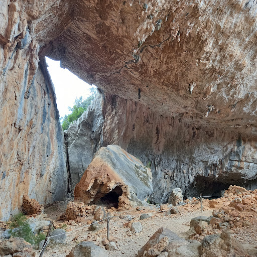
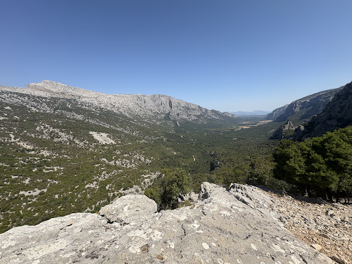
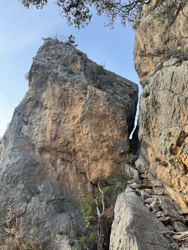
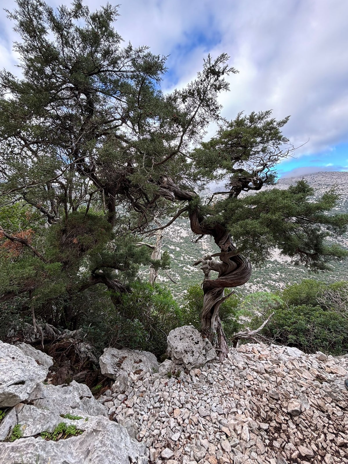
Tiscali
Monte Tiscali, 08022 Dorgali NU, Italy
4.7(279)
Closed

tickets
Save
spot
spot
Ratings & Description
Info
Tessellis S.p.A. is an Italian telecommunications company founded in 1998 and based in Cagliari, Sardinia, that provides Internet and telecommunications services in Italy, and, previously had operations ...
Cultural
Outdoor
Adventure
Scenic
Off the beaten path
attractions: Tiscali Trekking, restaurants: , local businesses:
Phone
+39 338 834 1618
Website
ghivine.com
Open hoursSee all hours
Sun9 AM - 5 PMClosed
Plan your stay

Pet-friendly Hotels in Durgali/Dorgali
Find a cozy hotel nearby and make it a full experience.

Affordable Hotels in Durgali/Dorgali
Find a cozy hotel nearby and make it a full experience.

The Coolest Hotels You Haven't Heard Of (Yet)
Find a cozy hotel nearby and make it a full experience.

Trending Stays Worth the Hype in Durgali/Dorgali
Find a cozy hotel nearby and make it a full experience.
Reviews
Live events
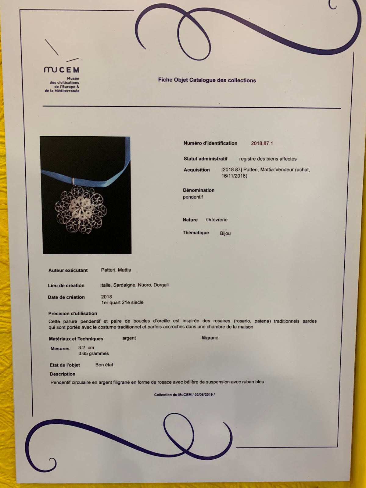
Create Sardinian filigree jewelry
Tue, Feb 10 • 10:00 AM
08022, Dorgali, Sardegna, Italy
View details
Guided hike to the hidden village of Tiscali
Sun, Feb 8 • 8:30 AM
08025, Oliena, Sardinia, Italy
View details
Nearby attractions of Tiscali
Tiscali Trekking

Tiscali Trekking
4.8
(45)
Open until 12:00 AM
Click for details