National Route 339 is a general national highway that runs from Hirosaki City, Aomori Prefecture to Cape Tatsubi. Of the total length of 129.3 km, the approximately 19 km connecting Tatsubisaki and Kodomari, Nakadomari Town is called the Tatsudomari Line. Construction began in 1972 (Showa 47) and was completed in November 1982 (Showa 57). It became passable in October 1984. It took 10 years to build, which shows how difficult the construction was.
The Kodomari side of the Tatsudomari Line was constructed by the Japan Ground Self-Defense Force. The Ministry of Defense's website states,
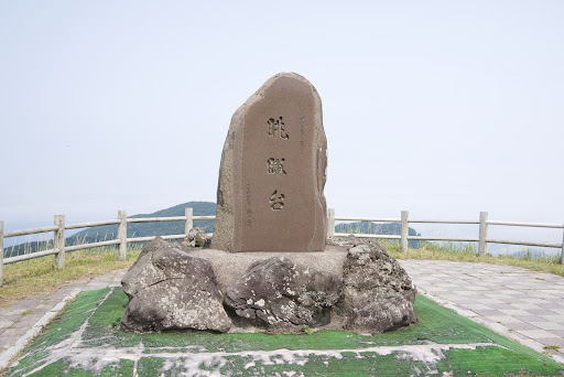
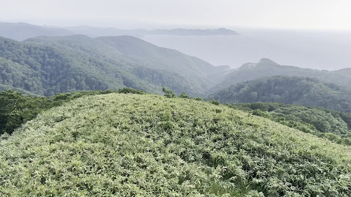
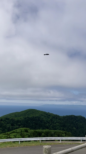
Of the 19.1km of the phantom road, 12.78km on the Kodomari side was contracted to the Ground Self-Defense Force and the 9th Facilities Battalion carried out the construction.'' The text reflects the pride that we took on this difficult project and completed it. The names of the homeroom work leaders are left on the bridges that span the Tatsudomari Line (Sato Bridge, Nagahama Bridge), and the names of the division commanders at the time are also engraved on stone monuments (Sakamotodai). thank you for her hard work. The observation deck is located at the highest point on the Ryudomari Line. There is a parking lot and toilets, so it's a great place to take a break. She can see the spectacular view from the parking lot, but she can enjoy an even greater panorama by climbing to the observation deck at the top. However, there are quite a few stairs to climb, so be prepared. While she was taking a break, she saw a bicycle coming from the direction of Nakadomari. She drove away comfortably down the road with almost no traffic. She's jealous...She'd love to see it someday! By the way, vehicles (including bicycles and motorcycles) are not allowed to enter the approximately 400m just before the end of National Route 339. There are stairs and only pedestrians can pass through. People call the stairs national highway. Although it has quite a slope and a number of stairs, it is a beautiful
national highway'' with hydrangeas in full bloom. If she has the time,...
Read more