Zvārtes Rock things to do, attractions, restaurants, events info and trip planning
Basic Info
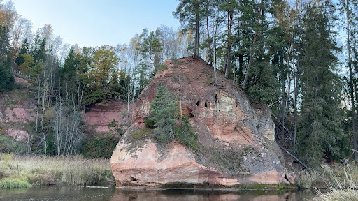
Zvārtes Rock
Zvārtes līcis, Drabešu pagasts, Cēsu novads, LV-4139, Latvia
4.8(537)
Open until 12:00 AM
Save
spot
spot
Ratings & Description
Info
Family friendly
Off the beaten path
attractions: , restaurants: , local businesses:
Phone
+371 29 252 126
Website
cesisinside.lv
Open hoursSee all hours
ThuOpen 24 hoursOpen
Plan your stay

Pet-friendly Hotels in Drabešu pagasts
Find a cozy hotel nearby and make it a full experience.

Affordable Hotels in Drabešu pagasts
Find a cozy hotel nearby and make it a full experience.

The Coolest Hotels You Haven't Heard Of (Yet)
Find a cozy hotel nearby and make it a full experience.

Trending Stays Worth the Hype in Drabešu pagasts
Find a cozy hotel nearby and make it a full experience.