Makalu Barun National Park is a national park in the Himalayas of Nepal that was established in 1992 as the eastern extension of Sagarmatha National Park. It is the world's only protected area with an elevation gain of more than 8,000 m (26,000 ft) enclosing tropical forest as well as snow-capped peaks. It covers an area of 1,500 km2 (580 sq mi) in the Solukhumbu and Sankhuwasabha districts, and is surrounded by a bufferzone to the south and southeast with an area of 830 km2 (320 sq mi).[1]
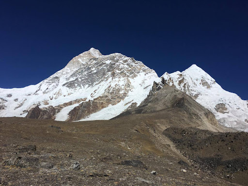
The rugged summits of Makalu, with 8,463 m (27,766 ft) the fifth highest mountain in the world, Chamalang (7,319 m (24,012 ft)), Baruntse (7,129 m (23,389 ft)) and Mera (6,654 m (21,831 ft)) are included in the national park. The protected area extends to about 66 km (41 mi) from west to east and to about 44 km (27 mi) from north to south. From the Arun river valley in the southeast, located at altitudes of 344–377 m (1,129–1,237 ft), elevation gains about 8,025 m (26,329 ft) to the peak of Makalu.[2] The national park shares the international border with the Qomolangma National Nature Preserve of the Tibet Autonomous Region in the north.[3]
The protected area is part of the Sacred Himalayan Landscape.[4]
History
Barun Valley
In the early and mid-1980s, personnel of The Mountain Institute (TMI), under its president Daniel C. Taylor conducted surveys in the Barun Valley to study whether an explanation could be found for the enigma of the Yeti.[5] Those surveys then uncovered this valley's extraordinary biological richness. The results of these surveys led to interest in creating a new protected area. A respective proposal was formulated in 1985.[6] In 1988, the Makalu-Barun Conservation Area Project (MBNPCA) was initiated as a joint endeavor of the Department of National Parks and Wildlife Conservation and TMI.[3]
The MBNPCA was officially gazetted in 1991. At the time, about 32,000 people resided in the conservation area's 12 Village Development Committees, who are primarily subsistence farmers of the Limbu, Sherpa, Yakkha, Gurung, Tamang, Magar, Newar, Brahmin and Chhetri ethnic groups. An innovative community-based conservation approach emphasized the management of biodiversity with local communities. Community Forest User Groups were created with legal rights to use designated forested areas on a sustainable basis. Ecotourism was promoted as a way of expanding off-farm employment opportunities for local people while at the same time minimizing negative environmental impact. Hunting and trapping of rare and endangered wild animals is strictly prohibited in the MBNPCA, except in extreme cases of threat to human life. There was also a provision for compensating farmers for crop and livestock depredation caused by endangered species.[7]
In 1999, the conservation area was converted into a buffer zone.[1] Under the Buffer Zone Management Guidelines the conservation of forests, wildlife and cultural resources received top priority, followed by the conservation of other natural resources and the development of alternative energy.[8]
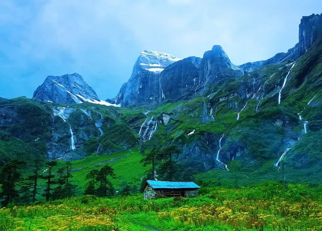
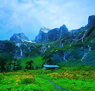
The inaccessible valleys of the Barun River, the glacier-fed tributary to the Arun River, treasure some of the last remaining pristine forests and alpine meadows. This area has been designated as a Strict Nature Reserve, the first in Nepal, in order to protect natural ecosystems and processes in an undisturbed state for scientific study, environmental monitoring, education and the maintenance of genetic resources.[2]
Climate
The park is located in the eastern climatic zone of the Himalayas, where monsoon starts in June and eases off in late September. During these months about 70% of the annual precipitation of 4,000 mm (160 in) falls. The first monsoon clouds reach the area in April. Temperatures vary greatly due to the extreme difference in altitude in the entire area. Lower elevations are temperate throughout winter and hot during April and May. The tropical and subtropical zones are frost free, with average monthly mean temperatures above 18...
Read more