Mt Isobel Summit things to do, attractions, restaurants, events info and trip planning

Basic Info
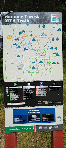
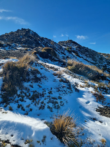
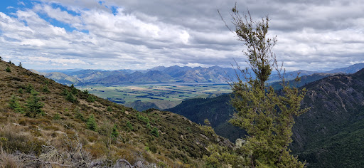
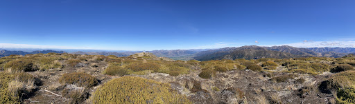
Mt Isobel Summit
Hanmer Springs 7395, New Zealand
5.0(14)
Open until 12:00 AM
Save
spot
spot
Ratings & Description
Info
Outdoor
Adventure
Scenic
Off the beaten path
attractions: , restaurants:
Website
visithurunui.co.nz
Open hoursSee all hours
MonOpen 24 hoursOpen
Plan your stay

Pet-friendly Hotels in Canterbury
Find a cozy hotel nearby and make it a full experience.

Affordable Hotels in Canterbury
Find a cozy hotel nearby and make it a full experience.

The Coolest Hotels You Haven't Heard Of (Yet)
Find a cozy hotel nearby and make it a full experience.

Trending Stays Worth the Hype in Canterbury
Find a cozy hotel nearby and make it a full experience.