An excellent day tramp is the walk between the Aniseed Valley car park and Hacket Hut. The carpark can be found at the end of the sealed portion of the Aniseed Valley road (approx 10km in total from Richmond); plenty of parking is available.
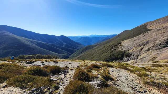
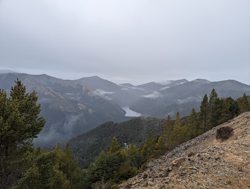
Several tramps start from here (Hacket Hut, Whispering Falls, Browning Hut) - and all share the same initial track segment which follows the river for about 50 minutes of walking before the first "decision point".
This first section of the track is mostly a steady low-gradient climb; it follows a logging truck track for the first 10 minutes and around 5 minutes later takes you to a long swing bridge. The next 1/2 hour is uneventful walking; there's a few muddy spots along the way - no problem to get through, but you'll probably end up with wet feet (and muddy shoes) if you're attempting this in normal running type shoes.
The track branches at one point on this segment and it's not clear which branch to take; they end up joining up again after only a short distance - the "high" track gets you around a bit of track degradation that's "passable" when heading up the track but a bit risky when heading back the same way. If in doubt, just take the high fork.
Towards the end of the first segment the track has suffered from a couple of slips - the track has been re-worked to get people through these areas, but you just need to slow right down for a minute and pick your steps carefully. These areas are quickly passed.
Not far past the damage the track splits; the left fork peels off and heads towards Whispering Falls whilst the track to Hacket Hut continues straight ahead. The gradient of this portion of the track increases considerably over the first portion - I personally don't find this portion "harder" so much as "just a little slower".
At about the 1.5 hour mark the track briefly ascends into the forest; the gradient of this portion increases dramatically, but it only lasts for about 4 minutes - from that point the track starts descending towards the hut.
Approx 10 min later trampers will cross a small stream and may end up on a dirt road used by 4 wheel drives and be wondering "do I turn left or right". The short answer is "neither" - you've actually come just a few meters too far - the track continues to your left just before you get to this road - just keep an eye out for the triangular track markers and you can't go wrong.
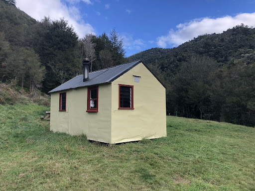
At this point, you're very close (only about 10 minutes away) - just stick to the track and before too long you'll see a sign pointing to a right-hand fork in the track - and just a minute or so later you'll see the hut.
It is possible to cross through the river to get to the hut - but far far far easier to just continue another couple of hundred meters down the track and walking over the bridge.
Count on the entire trip from carpark to hut taking at least 90 minutes (if you're fit) and 2 hours if you're a bit slower (like me). Be sure to take sufficient hydration (I need a couple of litres to get me from carpark to hut to carpark). There's plenty of river water right next to the hut, but you probably don't want to risk drinking it without some kind of purification.
Personally, I like to eat a meal at the hut before heading back - it does wonders for energy levels. The tramp back takes about 10m less due to being all down hill (I like to start a movie playing on my smartphone and just listen to it on the way back).
Keep safe folks - give some serious thought to carrying a raincoat and a basic first aid kit; there's no cellphone reception and you're in the middle of nowhere if something goes wrong. Be sure to tell someone where you're going and when you'll be back - it takes me about 5 hours from carpark to car park including a meal and a rest at the hut.
I've found a mapping GPS app on my smartphone to be invaluable (with car park and hut coordinates entered as waypoints).
Hope this...
Read more