Galdhøpiggen things to do, attractions, restaurants, events info and trip planning
Basic Info
Galdhøpiggen
2686 Lom, Norway
4.8(480)
Open 24 hours
Save
spot
spot
Ratings & Description
Info
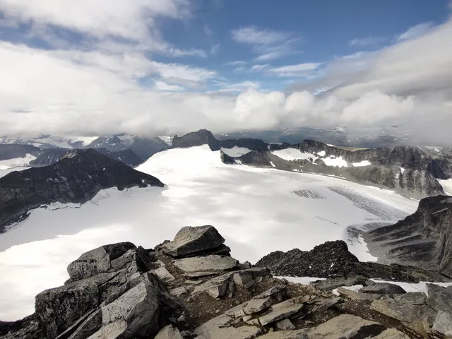
Galdhøpiggen is the highest mountain in Norway, Scandinavia, and Northern Europe. The 2,469-metre-tall mountain is located in Lom Municipality in Innlandet county, Norway. It is in the Jotunheimen mountains within Jotunheimen National Park.
Outdoor
Adventure
Scenic
attractions: , restaurants: , local businesses:
Phone
+47 61 21 29 90
Website
visitjotunheimen.com
Plan your stay

Pet-friendly Hotels in Lom
Find a cozy hotel nearby and make it a full experience.

Affordable Hotels in Lom
Find a cozy hotel nearby and make it a full experience.

The Coolest Hotels You Haven't Heard Of (Yet)
Find a cozy hotel nearby and make it a full experience.

Trending Stays Worth the Hype in Lom
Find a cozy hotel nearby and make it a full experience.


