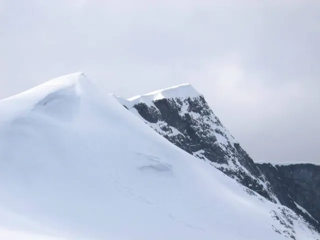
The 2,452-metre (8,045 ft) tall mountain is the second highest mountain in Norway. It is located in the Jotunheimen mountains
(known as the "giants") located within the stunning Jotunheimen National Park. One of our favourite places in the world 🌎
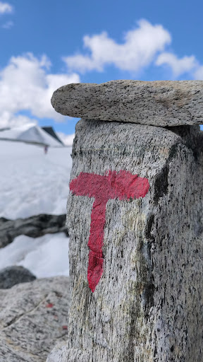
From our perspective, it's an easy hike. Well marked with the DNT tourist 'Red T's' It has rocky terrain but it's mostly stable, with a steady ascent, no up and down, just Up :-). We completed in the summer so it was good weather, but of course exposed, so take everything you need with you. We made it to the summit in under 2 hours but took our time, plenty of stops for photos and playing in the snow ❄️ the advise is 3-4 hours for the ascent and 1-2 for descent.
In our opinion, anyone can do this hike if you are prepared mentally and physically. Its fine for kids, dogs and unicorns but remember it's at altitude, so you will naturally be weaker and out of breath more easily. It's approx 6.5km one way so 13km both ways to/from the DNT cabin. You can pretty much see the summit from the start which is a great incentive, you can give yourself/others small goals along the way to break up the challenge, walk to each DNT marked Cairn which are easy to spot for example.
If climbing in the winter time, be aware Axe and crampons may be required when the final slopes are iced, so carry ice gear to be on the safe side.
*BUT what they don't tell you.... *There are only 2 access points to the start of the climb (Jotunheim DNT cabin);
-
The Eastern route is from Veodalen Parkering, co-ordinates are: 61.6715035, 8.7174391 and is
1100m ascent. The access road in, is a Bom/toll road at a cost of 60NOK regardless of vehicle size. (NOTE for some reason it says the road is closed on Google maps, but it isn't, so don't be out off!) The road Is approx 20km long and an ARSE.. pot holes, gravel and steep in some parts. No problem for cars but for a 4.5t campervan it caused us a few problems on the ascent. As with any Norwegian road, watch out for the mountain Mafia 🐏 🐑 they are poised ready to run out at any moment, or just casually sleeping in the shade on the road! There are plenty of passing points though and its a great view up to the parking point.
Plenty of parking for probably 50 cars and maybe 10 for campervans. There are no facilities here apart from an outdoor toilet. Be sure to take anti mig/Mosquito 🦟 stuff as there was plenty at dusk and dawn.
From here its a 7.5km bike ride or hike to DNT Glitterheim cabin, its worse going than it is to return. You can hire a bike at the cost of 100NOK per person, but we had our own so we would advise you to come prepared otherwise it's an additional 15km hike (7.5km either way) ontop of Glittertind.
-
The Western route, starting from Spiterstulen is approx 16km hike and works out at approx a 1300 meters climb.
So its either a 16km hike or 15km bike ride, the choice is yours 😁
DNT cabin had lots of facilities, toilets even showers, a cafe and even ol/beer 🍺 they also have rooms available or you can camp and use the facilities. There is no WiFi here.
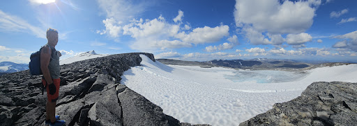
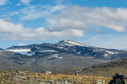
The hike itself is easy and straight forward with a steady incline. The summit was amazing with great views across the glacier and surrounding mountains, however there was no "summit point" cairn, sign, book or anything to mark your glory that you had arrived and the challenge you had completed. No problem for us but it could be disappointing for some. We have been spoilt and climbed alot of mountains in Norway and acoross the world, so for us Galdhøpiggen was more spectacular but of course it was 5x more challenging and not for for everyone.
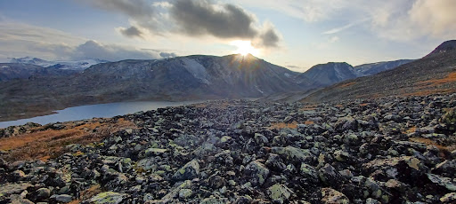
We decided to complete a loop back too the DNT via Glitterrundhøe 2089m and Ryggjejøe 2142m. 17.2km total but we wouldn't recommend it.. extremely slow going due to the steinrøys/landslide rocks. Relentless bouldering on an unstable footing. It was tiring and ankle breaking waiting to happen. No signage so clearly not a recommended route, although the views were amazing and we got to experience sunset by the...
Read more