To summarize in a sentence, it is an amazing hike, not long, not short, simple in initial parts & a bit challenging towards the later stages.
I am writing this detailed review keeping in mind that I went through bus from Sandnes terminal (Route 29 to Dale).
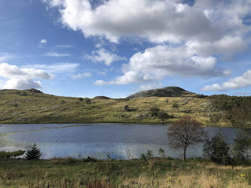
We got down at Gramstad bus stop and from there is approx 30 min uphill walk till the Parking lot at Gramstad. There are 2 main routes: one from Gramstad & anothe from Dale. Route from Gramstad is simpler and recommended for people coming with family/pets. It is also more scenic as it passes by the lake. This route has further 2 options just a few minutes from the start. One is clockwise & another anti clockwise. I felt anticlock wise is better for going up and the other for maybe coming down since the anti clock wise is a bit steep towards the last 25% of the trek and requires a slight bit of rock climbing, so I reckon this will become a bit difficult to get down. Also I found this anti clock wise route a bit more scenic and it also passes for a brief period through a small forest.
Both these clock wise & anti clockwise routes have a gradual incline for almost 60% of the trail and then it starts becoming steep once you cross the lake. At around 75% of the anti clockwise route joins the route from Dale. We used this route to Dale to get down.
The Dale route hike starts from almost the sea level and hence takes time and is a proper incline trek right from the beginning. The bus drops almost 5 minutes away from the start of the trek at Dale bus stop, 2 stops after Gramstad bus stop. So people coming by bus who do not want to walk on the road (like from Gramstad bus stop to the parking lot) & those who are looking for a decent trek right from the beginning may take this route. This route is not as scenic as it mostly passes through the cover of trees. We found that both the Dale route & the clockwise route can become slushy while the anti clockwise route can become very slippery towards the end part. Choose your routes accordingly.
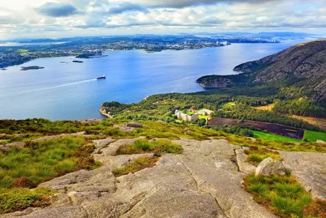
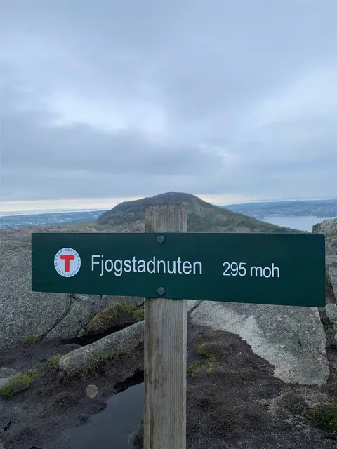
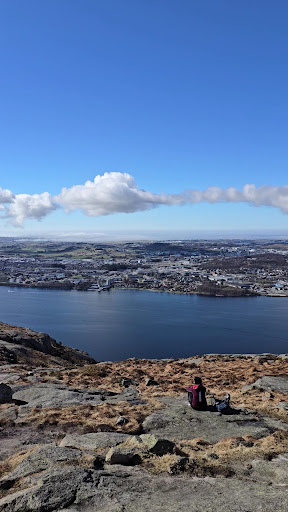
The top is beautiful with views of Sandnes-Stavanger on the other side and the mountains-lake on the climbing side. There are enough red colour markings on all the routes either on stones or tree trunks to keep you guided. The small forest towards the beginning of anti clockwise route has few cabins for shelter & barbeque where one can have a...
Read more