Luzon Datum of 1911
Luzon Datum of 1911 things to do, attractions, restaurants, events info and trip planning
Plan your stay
Posts
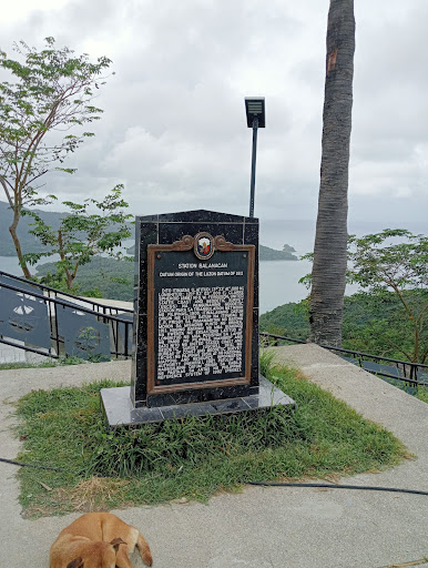
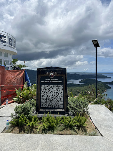
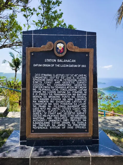
The place is well developed. The hike to the peak is completely paved with steps that are not even too high or far from each other. The way is very steep though and it took around half an hour to get to the top. The road for motor vehicles (at least that is what I think it is) is still unfinished. When you get to the peak, there is a big statue of the Virgin Mary in addition to the stone marking the "center of the Philippines". There is also a slab of stone explaining why that stone is recognized as such, specifying the longitudinal and latitudal coordinates of the Philippines. The area of the peak seems to be well lit since there are several lamp posts. Also, the view from the peak is very beautiful since you are able to see the coast of the island of Marinduque from multiple directions. On the way up, the view was also beautiful.
Kevin Molato
00
If you’re into geography, history, or just love scenic views, the Luzon Datum in Marinduque is a cool little spot to check out! It’s the geodetic center of the Philippines—basically the reference point for all land surveys in the country. Pretty neat! The usual way up involves a short but steep hike, so wear comfy shoes if you’re walking. But if you have a motorcycle, good news—you can actually ride all the way to the top and skip the hike entirely! At the summit, you’ll find a historic marker, a small monument, and an amazing 360-degree view that’s totally worth the trip. Super chill spot for a quick stop, photos, or just taking in the view. Best of all, no entrance fee! There’s just a donation box if you want to chip in to help with maintenance.
Lyndy Baradero
00
Going to Luzon Datum was a bit of a challenge. The road was a bit steep and the car had a hard time going up but in fairness the road was really developed and wide, so it's really not that scary travelling even if it's uphill and near the creek. Upon reaching the parking area and the entrance going to Luzon Datum there will be another challenge that you need to complete, you need to climb the stair, around 400-500 steps. I remembered resting for a couple of times going up to catch my breath. It was a very tiring experience. However, once you reach the top you will see the majestic 360 degrees view of the island of Marinduque. All worth it!
Bryan
00
Got to visit Luzon Datum every time I go to my home town. Luzon Datum is the geodetic center of the Philippines. To go up the top, there are two ways: stairs via 14 stations of the cross which i prefer as there shades along the way to protect you from the blistering heat of the day, or the road around the back that leads all the way up to the top.
Gina Grape
00
Established in 1911, Luzon Datum located in Mogpog, Marinduque, is a short 1.8km hike🧗 from the jump-off. It's significant and unique to Marinduque. This piece of stone 🗿marker is the primary origin or reference point for maps 🗺️and surveys in the Philippines. Some says Luzon Datum is the Heart or Center of the Philippines.🇵🇭
Subhass S
00
Luzon datum of 1911 USCGS to BCGS to NAMRIA in support for PRS92 the partner of balanacan station mojon marker was on baltazar island in the municipality of gasan,marinduque.
Arnold Santos
00
- Please manually select your location for better experience