LENGTH: 2 KM (1.2 MI.)
TIME: 40 MIN.
DIFFICULTY: EASY
TOTAL ASCENT/DESCENT: 218 M (715 FT.)
At the very end of the road on the edge of Bel Ombre, you will see a drinking fountain on your right. The
trailhead is very close by on your left, past a chain that prevents vehicles from entering the track. The main
overlook for the trail is located 1.5 km (1 mi.) away. Budget 30 minutes to reach the shelter that looks out onto
two enchanting creeks. You will reach these about 10 minutes later.
The first part of the trail can be a little churned up at the end of the rainy season due to run-off. After this, the
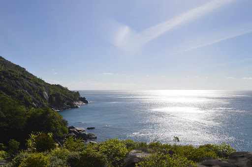
walk becomes more pleasant, with granite underfoot. The path cuts crosswise across an immense glacis. On
your right, the ocean and the horizon, dotted with a few islets. Below, the shifting turquoise colors where the
waves meet the rocks. To your left, an array of somewhat unusual plant life.
The drier coastal ecosystem bathed by the sea spray has some surprises in store. There are the cocoplums
(Chrysobalanus icaco) and the royal poinciana (Delonix regia) that turns red in December. Pleomele (Dracaena
reflexa) and hard alstonia (Alstonia macrophylla) also rear their leafy heads against the azure sky. On the
ground are a multitude of succulents, including agave plants whose pointed leaves will tickle the calves of
passing hikers. You will also see the coral wood trees (Adenanthera pavonina) whose bright red seeds are
used to make jewelry.
Nearly flat for most of its length, the trail occasionally crosses some natural hollows, including Roche
l’Eglise. Its walls are covered with old wasp nests made from dried mud. Views of the ocean regularly reveal
themselves as you come around a bend. At times the glacis descends straight into the sea, mixing the blue
of the open ocean and the green of the guayacan trees, another species that has become rare and precious.
Avoid straying from the trail on the glacis, especially on the ocean side where hikers can be trapped by the
crevasses. Take care on the rocks as well, as these can be slippery. Some sections are equipped with security
chains, and we recommend waiting until the end of the trail to get near the water.
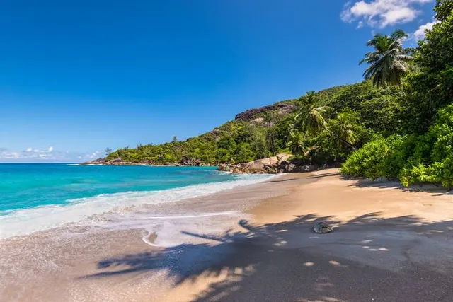
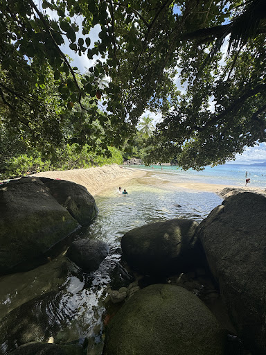
When you see the shelter ahead, you will know that the end is in sight. It overlooks the famous Anse Major,
which you will want to reach as soon as possible to enjoy a swim in this magical setting. It is actually made up
of two small bays in one, separated by only a few large rocks. The second, larger bay is a curving thin band of
sand where the ocean, forest and river meet. On one side, there is warm salt water. On the other, it is cool and
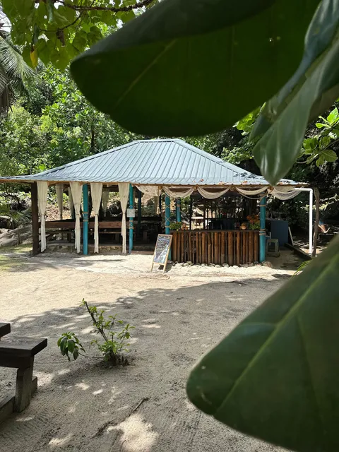
fresh. If you are hiking with a guide, be sure to ask them to find a cool coconut for you. A must-try. Note that
you can reserve a private boat and sail directly from the beach for a faster return journey to Bel...
Read more