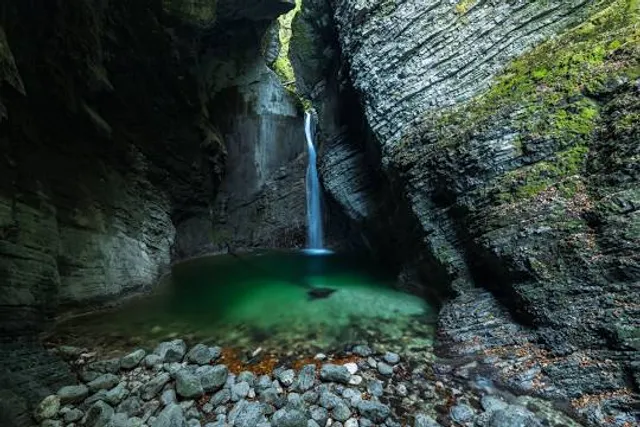
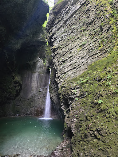
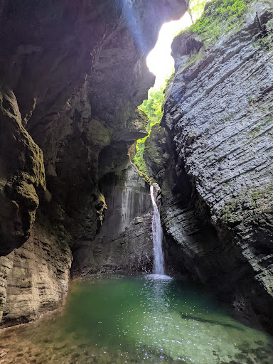
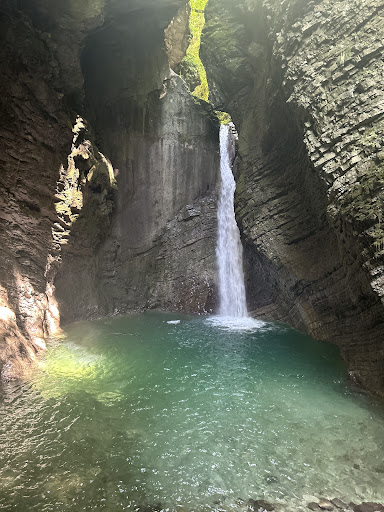
The Kozjak Waterfall (Slap Kozjak), located near Kobarid in western Slovenia, is not only visually stunning but also geologically fascinating. It's nestled in a narrow limestone canyon, and the geology around it tells a much older story than the waterfall itself.
🏞️ Geology of Kozjak Waterfall
Rock type: The canyon and surrounding area are predominantly composed of Upper Triassic to Lower Jurassic limestones, especially micritic limestones, which formed in shallow marine environments around 200 million years ago.
Formation of the canyon: Over time, the Kozjak stream eroded its way through the carbonate rock, carving out a narrow gorge. The soft, soluble nature of limestone, combined with tectonic uplift and high water flow, makes the area ideal for karstic erosion (i.e., caves, sinkholes, and gorges).
The waterfall: Kozjak Waterfall itself formed due to differential erosion—harder rock layers resisted erosion, while softer layers were worn down by water. The water plunges 15 meters into a dark, cave-like amphitheater—almost like a natural cathedral.
🪨 Stratigraphy and the Canyon's Layers
The canyon walls show visible stratification, horizontal to slightly inclined bedding planes, and occasional fault lines or fractures.
In some places, the layered appearance may include dark bands (sometimes rich in organic material or clays), which could be interpreted as markers of significant geological events, including:
Anoxic events (periods with little to no oxygen in oceanic environments)
Volcanic ash layers or other sedimentary signals
Possible links to mass extinction horizons, particularly the Triassic–Jurassic extinction (~201 million years ago)
While no specific extinction layer is marked or officially studied in the Kozjak canyon itself, similar formations in the Southern Alps and Dinarides region do include geochemical or fossil evidence of the end-Triassic mass extinction, one of the five major extinction events in Earth’s history.
🔍 Possible Geological Indicators of Mass Extinction:
If you're seeing distinctive stripes, they could be:
Black shales or marl layers: Indicative of low-oxygen conditions.
Clay-rich layers: From rapid climate shifts or volcanic activity.
Fossil-poor vs. fossil-rich layers: Extinction events often lead to abrupt changes in fossil presence.
Conodont or ammonite zones: Used globally for biostratigraphy across the Triassic-Jurassic boundary.
You might be onto something if the Kozjak canyon indeed exposes transitional layers from the Upper Triassic to Lower Jurassic, as Slovenia is well-known for having excellent exposures of this time period in other regions.
🧭 Extra Fun Fact:
The Soča River basin, where Kozjak lies, was shaped by both tectonic activity (due to the collision of the African and Eurasian plates) and Pleistocene glacial meltwater, which also contributed to...
Read more