The Salt River Mouth trail - 5 November 2021. This coastal trail is situated in the beautiful and peaceful Nature’s Valley. Nature’s Valley is a quiet little holiday coastal town close to Plettenberg Bay in the Western Cape, South Africa.
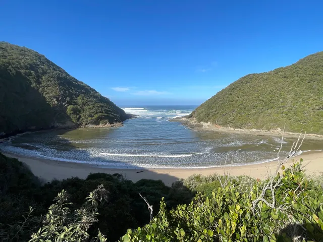
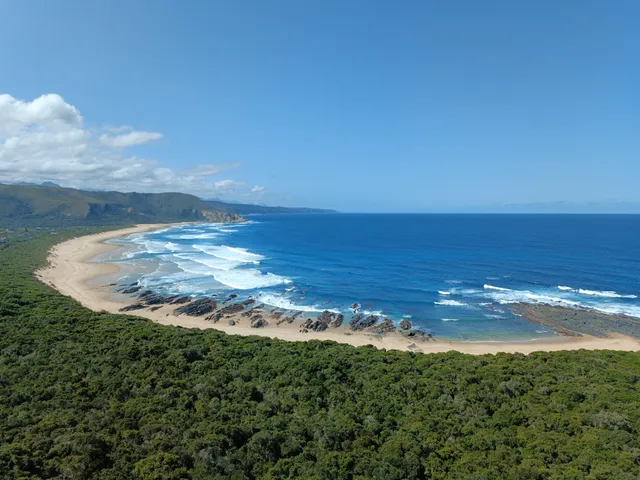
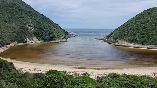
We started the trail at the wrong spot and walked down the beach for quite a distance. This was not a problem as everyone loves long walks on the beach. For the most part the trail traverses through dense bushes. The bush path was a bit of a let down, since we wandered through the Knysna forest the day before. Coastal plants and shrubs don’t have the same enchantment as a deep forest and its ancient trees and ferns for me personally. Along the way you reach a viewpoint looking over a stunning long stretch of beach (the romantic long beach walk whence we came from). The splendour of the Salt River Mouth trail is evident when you reach the mouth of the Salt River.
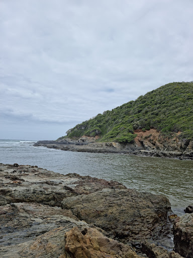
The river segregates the bush and forest. One moment you are engulfed by shrubs and the next you enter a clearing of sand and flowing water. I get a kick out of how nature transforms in an instant. Here you have the opportunity to remove your shoes and drive your feet and toes into soft sand. The emerald canopy of the forest in front of you is stunning. Turn your gaze to the north and you see a mantle of green as the forest canopy continues in this direction. Look to the south and you see what is called Mermaids Cove. The cove is a lovely, secluded little beach surrounded by rock and stone; the perfect spot for mermaids and sirens to lure men (who are naturally weak of will) with their beauty and charm. Unfortunately we did not encounter any mythical sea creatures, though we were beguiled by the beauty of the cove.
We score the Salt River Mouth trail as follows: Overall Score: 7/10 Cost: Free 
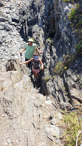
Difficulty: 2/10 (Not difficult at all) Technical: No Views: Yes Pools and Waterfalls: No waterfalls, but a lovely river stream down to the ocean. Crowds: We were alone for the most part with a few other couples on the trail and...
Read moreDespite many sites saying you have to purchase a permit at Vassensloot Camping site, we went there, and this is not the case. Cape Nature says there have not been any permits issued for 2 years. The map issued at Cape Nature is not as accurate as the pictoral 1 - 8 I got from Charne at the Natures Valley Trading Store in my pics(attached). We walked the trail accidently back to front as on the 250m beach you already see a sign on the right 'Salt River via Naters Valley view point' On the pics you are meant to walk on PAST THIS SIGN and then you shall reach the rocky outcrop that climbs upward which hugs the mountainside. The railing is rickety and broken so be carefull. You then climb down left over the gulley, which is not passable at high tide. When you walk this way, the trail comes out on the side of the wide shallow lagoon with misleading signs that say dangerous, etc... If you walk as did we and 2 other couples the other way around you walk on exit the bush on the river. (My photos are in sequence as we walked) As it was low tide, we walked on the edge of the water on the beach and along the steep rocky cliff only to see the wooden steps on your left with lower stairs damaged by recent storms. DO NOT walk around the rocks where fishermen stand. THIS IS NOT THE ROUTE. Hope the pictures help. The trail, including viewpoint pics and 20 minute swim in the safe shallow bay, returning to the parking lot at Natures Valley Trading store 2 hours 10 minutes. DO NOT hike in slip shops, tackies, or boots required. Pack a costume and picknick a great place for families' safe water and no sharp rocks....
Read moreDirectly across from Nature’s Valley Trading Store are public toilets where the cement trail leads to the beach. At the beach turn right and about 200 meters there will be a green sign at the edge of woods that reads “Salt River via Nature’s Valley Lookout”. This begins the hike up through the woods. Be sure that you check the tides so that low tide is about an hour after you start so that you will not have to double back. After 40 minutes or so there will be a small green sign at a wide intersection where you turn left then head to Brak River. Walk along the river bed to the left and toward the ocean. At the base of the craggy rocks to the left there will be a sign at some scary looking “stairs” that indicates the Blue Beach trail is dangerous due to rockslides and is inaccessible. If you are an experienced hiker and the trail is dry and you are at low tide then continue up that trail. At the beach (rescue point 70) continue left. From here on until you get back to the original beach you started from, you will have to pick your way through the rocks. Tip: keep to the left when you run into problems and don’t be afraid to backtrack as there are no trail markings - just beaten paths. At one point there is a section with a rope rail but that’s the only indicator of the trail. The hike is varied and beautiful and the wildflowers in the spring, just lovely. Leave yourself...
Read more