Marakele National Park, nestled in the heart of the Waterberg Mountains in Limpopo Province, South Africa, offers a compelling contrast to the country’s more arid or open savannah reserves. A look at the map of Marakele reveals a striking blend of rugged mountain terrain, winding forested valleys, and grassy plains—making it a remarkably diverse and scenic conservation area.
The park is divided into two distinct zones, which the map presents with clarity. The southern sector contains the main reception area and entrance gate (accessible near Thabazimbi), and is where visitors will find most of the self-catering accommodation options such as Bontle Tented Camp and campsites. This area is also where standard 2WD vehicles can comfortably navigate. The road system here, clearly marked on the map, is relatively compact and loops through open savannah and acacia woodlands—prime areas for spotting rhinos, elephants, and antelope.
The northern sector, on the other hand, is accessed via a private, controlled gate and is only reachable by 4x4. The map rightly highlights this difference with separate labeling for 4x4 trails. Here, the terrain becomes steeper and more dramatic as it ascends into the mountainous Waterberg escarpment. The Klipkraal and Tlopi Tented Camps are noted on the map along the Apiesrivier—this stretch of river valley is particularly picturesque, and the camps offer a serene, wild experience.
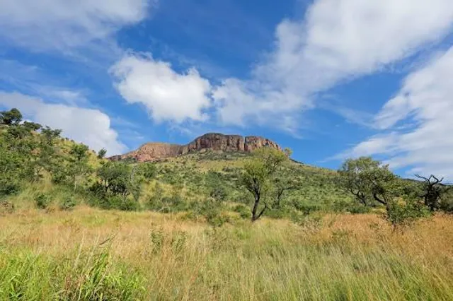
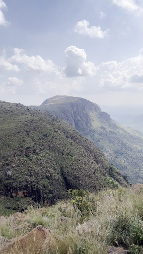
Perhaps the most iconic feature visible on the map is the Lenong Viewpoint—marked high up in the northern region. It’s one of the park’s most breathtaking lookouts, accessible via a winding 4x4 mountain pass. From here, visitors can take in panoramic views of the park’s undulating landscapes and spot the famous colony of Cape vultures soaring overhead. The road leading to this point is steep and challenging, and the map's elevation lines and terrain markings help convey this dramatic shift in altitude.
Water sources such as rivers, dams, and seasonal waterholes are also represented, and while Marakele is not as waterhole-centric as Kruger or Etosha, the presence of the Apiesrivier and other natural drainage systems adds richness to the ecosystem. The map provides insight into how these features support diverse wildlife and lush pockets of vegetation, even in dry months.
Another useful aspect of the map is the park's boundary with the greater Marataba section, a private concession that is sometimes shown for orientation. While access to Marataba is restricted to lodge guests, its presence on the map helps illustrate the broader conservation area and connectivity with adjacent reserves.
The park’s biodiversity is mirrored in the topographic detail of the map. The dense green areas reflect thick bushveld and forested slopes, while the flatter southern regions are lighter in tone, indicative of savannah and grassland. This visual guide helps visitors anticipate what types of flora and fauna to expect in each zone.
Overall, the map of Marakele National Park offers more than just directional assistance—it’s a window into the park’s natural contrasts. From lowland plains teeming with game to towering peaks that touch the clouds, the map paints a vivid picture of a hidden gem in South Africa’s conservation landscape. Whether you're a self-driver or an off-road adventurer, this map is an essential companion to unlocking Marakele’s...
Read more