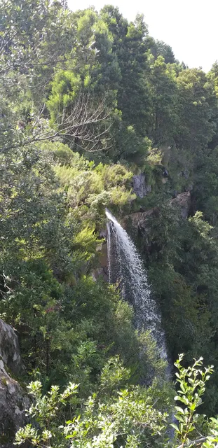
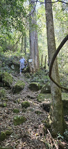
Here's how to get there (Upper Deck via Forest Drive): Starting from the Main Road, walk down on the way to the Arboretum but turn right to the Forest Drive. After 10min of walking (800 metres), the road will split into two: choose the left one. After about 5min (300m) the road will split further into two: left turn (upper deck) and right turn (lower deck). Choose the left turn. It will then be a mild uphill climb. After 800m uphill, there will be a sharp bend to the left. But keep your eye on the right side for the sign board (piggy trail sign) to the Kettlespout Falls upper deck. It will be a narrow trail, a bit steep and slippery at the beginning. It will take 15-20 minutes to get to the falls. There will be a bench there for viewing.
Upper Deck (via Hobbiton): walk/drive about 2.5km from Main Rd via Wolfridge Rd. Turn left to go up to the Hobbiton. There will be a sign board on your right for the upper deck. It will be a steep ascent for about 30min, then 15-20 minutes relatively flat trail to the upper deck.
Lower Deck (via Hobbiton): First and foremost this is closed to the public. But if you wish to proceed, you can do so at your own risk as there will be no one around to stop you. Enter the "yellow route" at the very corner of Hobbiton (behind the obstacle courses). There will be a boardwalk for the first 50m, then the trail will split into 2. If you go straight you will end up at the thickets and is blocked by fallen trees. If you turn left, it will lead you to the bridge where "yellow" and "red" route converges (we're not sure where the entrance/exit to red route is). Then go further up and the trail will split into 2. The one going up is thickety and is blocked by a couple of fallen trees. You will end up not seeing the lower deck after all. The one going left is when you decide that you are lost, after you cross the bridge crossing the river you will exit by the logging area.. Then turn left to get back to the trail. If you see signboard A, don't turn right, turn left then you will be back to where you started safely...We were told by a local (after the hike) that the trail is closed as it is not well maintained and because some people are polluting the water which the locals use to drink...We got lost in the trail at least 4 times. If you don't admit that you are lost then you will be going in the wrong direction for a long time..Just use the river as a guide and exit by the logging area then get to signboard A then follow...
Read more