Nilavarai Well: The "Bottomless" Well of Jaffna
The Nilavarai Well, also known as the Nilavarai Bottomless Well or Deep Well, is a fascinating natural wonder and popular tourist attraction in Jaffna, Sri Lanka. Here's a detailed description:
Location and Background:
Situated in Puttalan, in the Navakkiri GS area of the Valikaamam East division, roughly 14 kilometers northeast of Jaffna town.
The name "Nilavarai" might come from "Nilava'rai" (Nila + a'rai), meaning "underground chamber" in Tamil, hinting at its subterranean water source.
Unique Features:
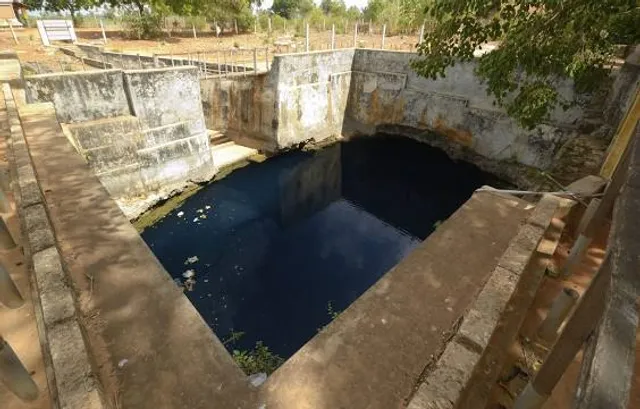
Nicknamed the "bottomless well" because it has never been known to dry up, even during severe droughts.
Recent explorations by the Sri Lanka Navy divers revealed a depth of 52.5 meters (172 feet).
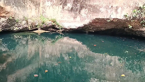
The well is rectangular, with a surface area of approximately 13 meters long and 10 meters wide (43 ft x 33 ft).
Steps lead down to the water level, which sits about 14 meters (46 ft) below the surface.
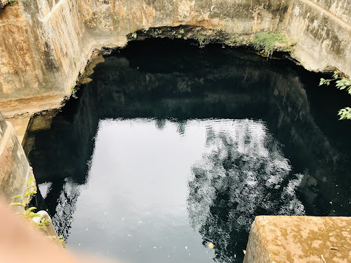
Interestingly, the water is fresh in the first 18.3 meters (60 ft) and becomes saltier as it goes deeper, suggesting a connection to the ocean.
The divers also discovered several tunnels branching out from the well at various depths, adding to the mystery of its formation.
Possible Formation:
Geologists believe the well was formed by the collapse of the top layer of earth, exposing a limestone cavern connected to an underground freshwater source.
The presence of saltwater at lower depths suggests a connection to the nearby ocean.
Cultural Significance:
The Nilavarai Well is a source of fascination and local legends.
Some believe it connects to the Keerimalai Sacred Water Spring through underground tunnels, though there's no scientific evidence to support this.
The well's consistent water supply has been a lifeline for the surrounding farming communities for centuries.
Visiting the Nilavarai Well:
The well is a popular tourist destination and can be easily accessed.
There are local vendors selling refreshments near the site.
Be mindful of proper decorum when visiting, as it's considered a place of cultural significance.
Overall:
The Nilavarai Well is a unique natural wonder that combines history, mythology, and geological intrigue. It's a must-visit for anyone interested in Jaffna's cultural and...
Read more