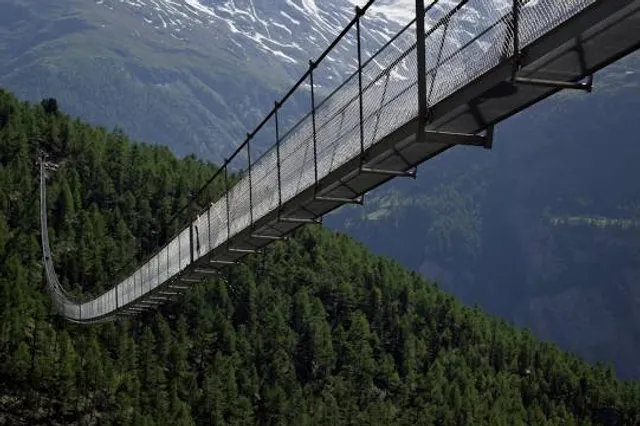
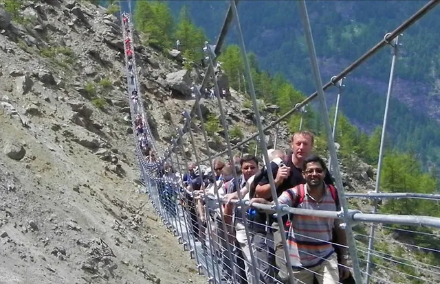
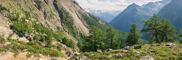
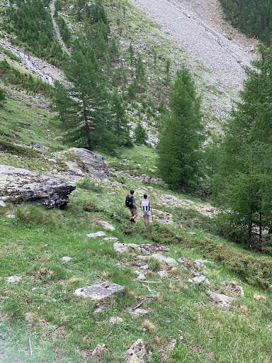
Visited this in late June 2019. Took the short train ride from St. Niklaus to Rand, loaded up with water in town (lots of spots to get water early but make sure you have enough as we found no water sources on the trail once outside of town), took a photo of the map at the train station area, and headed up thru town on the trail and into the mountains. Was a pretty warm day. The trail splits early but the path to the right was closed for some reason so all hikers had to take the left branch which we were told is a bit steeper and more challenging. The hike starts off fairly steep up thru the town of Rand and pretty much never lets up the whole way to the bridge. We kept a decent pace and made periodic stops to drink and rest a few minutes and it took us about 2 hours. A few people turned back along the way. It is definitely a pretty challenging hike and in a few places one had to be careful about footing, slipping, etc. Wear good hiking shoes/boots. Can see the bridge at times long before one gets to it. The bridge is a great place to stop and have lunch, etc. and of course everyone needs to walk across it (or at least to the middle if one going back down the same way they came). It is a bit strange at first as the decking of the bridge is sort of an egg crate structure and it is a suspension bridge so it sways and shakes, etc. as people walk across. Great views of the local mountains and glaciers from the bridge and the trail and can also see the town of Rand from the bridge. Few people went all the way across as the trail on the other side was closed. I am guessing 95%+ go back by way of the trail but two of our teenage (17 and 19) sons decided that walking down off the trail and following the creek that runs under the bridge and down into town was the way to go. We watched them walk down the hill to the creek and decided we (wife and I, 54 and 52, and oldest son and girlfriend, 22 and 21) would do it as well. Always up for something different and looked like it might be a nice change from the switchbacks, etc of the trail. Well, the hike down to the creek was not too bad but the hike down from there was pretty challenging as all admitted in the end. Took about 2 hours to get down far enough to hook into the trail shown on the map that is called Variante Alternative. We wound up crossing the creek fairly early on (only advisable when flow is fairly low) so we were on the left side looking down at the town of Rand. About 2/3 of the way down or so the trail to the left was fairly obvious as there is a concrete structure and a small open clearing (see last photo). Missing this would commit one to a fairly steep descent down the rocky valley to the town. After getting on this trail, one had to take a right at a fork (small wooden sign on a tree on the right, cannot remember what it said) maybe 10+ minutes after being on the trail, and we were back in town after about 30 minutes although it was a pretty steep if fairly easy hike down. We were then on the train to Zermatt to walk around and see the sites. Overall, the bridge is pretty cool and worth the effort but be prepared for a pretty solid hike and bring plenty of water, especially on a warm day. ...
Read more