Lilongshan South Trailhead things to do, attractions, restaurants, events info and trip planning

Basic Info
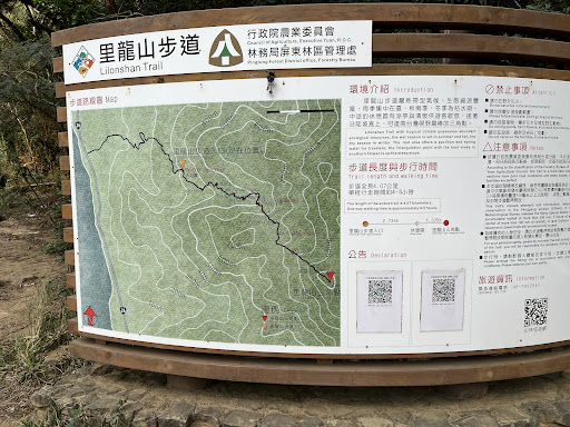
Lilongshan South Trailhead
943, Taiwan, Pingtung County, Shihzih Township
4.0(127)
Open until 12:00 AM
Save
spot
spot
Ratings & Description
Info
Outdoor
Adventure
Scenic
Family friendly
Pet friendly
Off the beaten path
attractions: , restaurants: , local businesses:
Website
hikingbook.net
Open hoursSee all hours
TueOpen 24 hoursOpen
Plan your stay

Pet-friendly Hotels in Shizi
Find a cozy hotel nearby and make it a full experience.

Affordable Hotels in Shizi
Find a cozy hotel nearby and make it a full experience.

The Coolest Hotels You Haven't Heard Of (Yet)
Find a cozy hotel nearby and make it a full experience.

Trending Stays Worth the Hype in Shizi
Find a cozy hotel nearby and make it a full experience.