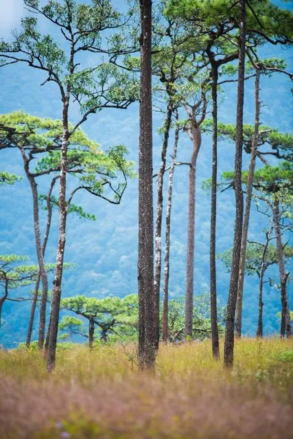
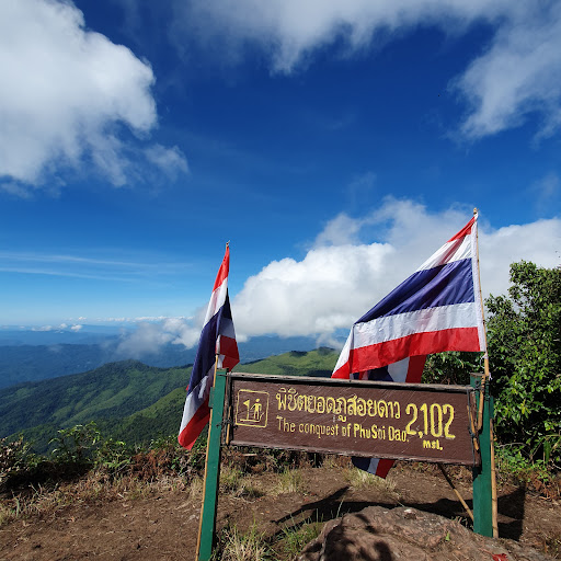
Phu Soi Dao is the 4th highest mountain in Thailand that you can visit. Topped by Doi Chiang Dao, Doi Pha Hom Pok, and Doi Inthanon. With the elevation of 2,120 meters or 6,955 feet, it is going to be a challenging climb for those who want to experience the mountain. It is located in Uttaradit province on the border between Thailand and Laos. Hence, you can cross into the Laos side at the marker but you cannot go too far beyond the marker.
How to get there?
Well, it's going to be a journey if you don't drive since it is impossible to go there by public transportation.
Option 1: Train
Train from Bangkok (Hua Lamphong station) to Phitsanulok about 6-7 hrs ride. Then bus from Phitsanulok to Chat Trakan District. That's another 2 hours. This is the last spot you can get your supply before ascending to the mountain. From Chat Trakan you have to hire private transportation (Tuk Tuk, truck, van) to Phu Soi Dao National Park. The price varies but should be around 1,200 THB range (+/- 20%).
Option 2: Bus
You can take a bus from Mor Chit station in Bangkok to Phitsanulok. Then get private transportation from the bus station to Phu Soi Dao National Park. I have no idea about the price from here.
Option 3: Fly
There are flights from Don Muang Airport to Phitsanulok almost hourly. Then hire private transportation to the park.
Option 3: Driver
Just follow Google Maps.
After you arrived then what?
Entrance fee is 200 THB for foreigners. It's possible to rent a lot of the necessities tenting gear from the park. It can get pricey as well. Beware since these rental gears can be in poor condition. Consider you're warned. The fee for hiring the porter to carry your stuff is 35 THB per Kg.
Package includes tent, sleeping bag, pillow, sleeping pad
Package 1 person 1 night = 945 THB
Package 2 person 1 night = 1,185 THB
Package 3 person 1 night = 1,425 THB
Package 1 person 2 night = 1,230 THB
Package 2 person 2 night = 1,530 THB
Package 3 person 2 night = 1,830 THB
When to visit?
The park is open seasonally from 1 July until mid-January of every year. If you want to see the field of blooming Murdannia then visit during the rainy season (July - October). The climb will be more adventurous too since you might get the chance to hike against the rain which turns the mountain into one giant waterfall.
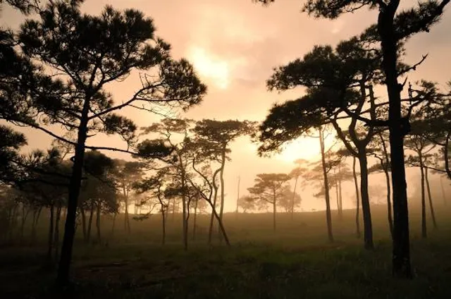
If you plan to take some awesome image of the Milkyway the visit after the rain ends. Usually, would be mid-October onwards. Then the fog usually opens up the clear sky for you.
The hike can be from 4-7 hrs to the campsite (1,633 m / 5,357 ft elevation) depends on your fitness level and weather condition. If you want to climb the real summit (2,120m elevation), it is open October and an additional 500 THB per person to climb the summit. The rangers will provide you with safety gear and lead the group to the summit. It takes about 7hrs round trip starting from the campsite.
PS. There is barely any phone signal at the campsite. There are a few spots where you can get faint signal. I recommend AIS for your best chance to get a signal. If you're on DTAC, you're kinda screwed.
Give me a thumb up if you find this...
Read more