Kaunos Ancient City: A Historical and Cultural Overview
Location: 
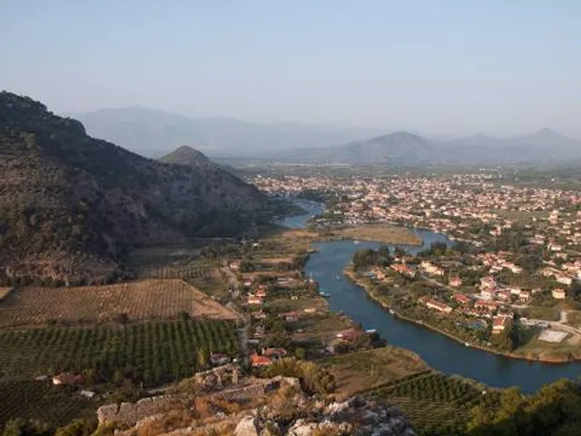
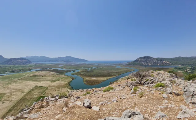
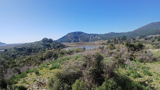
Kaunos is nestled in southwestern Turkey's Muğla Province, near the charming town of Dalyan. Once a coastal city on the Mediterranean, it now lies inland due to centuries of silting from the Dalyan River (Calbis River in antiquity). The ancient harbor, now a marsh, reflects the dramatic geographical changes over time.
Historical Background: Origins: Founded around the 10th century BCE, Kaunos was a Carian city with Lycian and Greek influences. Myth attributes its founding to King Kaunos, son of Miletos, who fled Miletus after a scandal involving his sister Byblis. Rule and Decline: Controlled by Persians, Hellenistic kingdoms, Romans, and Byzantines, Kaunos thrived as a trade hub until silting blocked its harbor. Malaria and Arab raids led to its abandonment by the 15th century CE.
Key Archaeological Structures: Rock-Cut Tombs: Carved into cliffs (6th–4th centuries BCE), these Lycian-style tombs feature ornate temple facades, symbolizing the city's elite. Theater: A 5,000-seat Hellenistic structure with Roman additions, offering views of the tombs and delta. Basilica and Roman Baths: The 5th-century CE basilica highlights early Christian influence, while the baths showcase Roman engineering. 
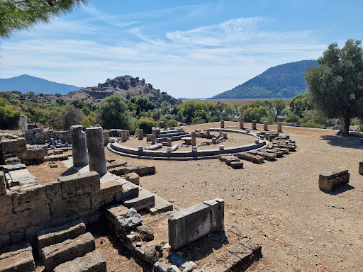
Agora and Temples: Public spaces and shrines dedicated to deities like Apollo and Basileus Kaunios, a local god. 
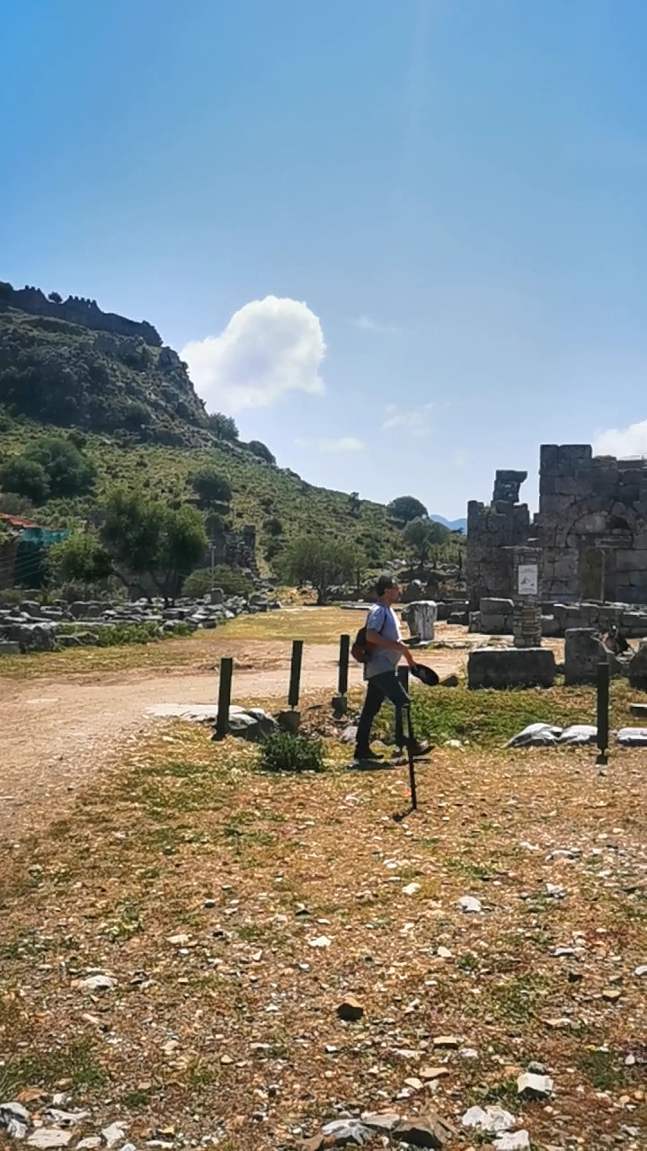
City Walls and Acropolis: Fortifications spanning centuries, with the acropolis providing panoramic vistas.
Cultural Significance: Kaunos was known for its distinct customs and language, as noted by Herodotus. The city blended Carian traditions with Greek influences, worshipping both local and Hellenic deities. Its mixed heritage is evident in art and architecture.
Nearby Attractions: İztuzu Beach: A protected nesting site for loggerhead sea turtles. Dalyan Delta: A biodiverse wetland ideal for boat tours and birdwatching. Dalyan Town: Offers thermal springs and traditional Turkish cuisine.
Visitor Tips: 
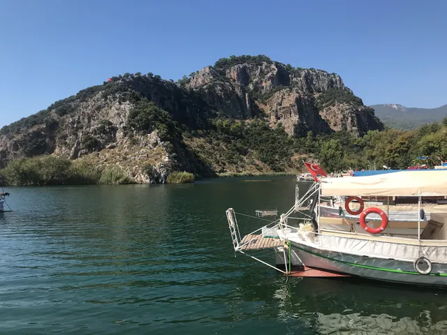
Access: Reach via boat from Dalyan (10 minutes) or a short drive. Nearest airport is Dalaman. Facilities: Wear sturdy shoes for uneven terrain; bring water and sun protection. Best Time to Visit: Spring or autumn for mild weather. Combine with a boat tour to explore tombs and the delta.
Conservation Efforts: Kaunos is part of a protected archaeological and natural site. Preservation work focuses on stabilizing ruins and protecting the surrounding ecosystem, including İztuzu's turtle populations.
Legacy: Once a vibrant port, Kaunos now serves as a testament to the interplay between human history and environmental change. Its ruins and stories continue to captivate historians and...
Read moreA fantastic archaeological site, unfortunately zero signage and lacking information.
To get to Kaunos you have three options realistic options:
Get the ferry across (it's a fair walk from Dalyan to the ferry crossing, but cheap to use the ferry)
Get a boat tour to take you, for exorbitant fees.. and they'll probably insist you go somewhere else instead
(Recommended) In the centre of Dalyan, opposite the Tombs, there's a rowboat service (from around 7am) that takes you over to the other side of the river (to where the tombs are) it costs a tiny amount to be rowed over (you pay once for a return) the cafe just over the river is an excellent stop too! A really relaxed place for a drink and a read. You then have a pleasant 20min walk to Kaunos passing some friendly locals selling some produce from their farms (honey, ice cold pomegranate or apple juice etc) the walk is along a well maintained quiet road, it's pretty flat and there's only an uphill bit right at the end by Kaunos and even that isn't much of a problem. There's also a tractor that takes people from the dock to Kaunos (I preferred to walk)
When you arrive at Kaunos it's a small fee to get in (€6) and you are left to your own devices.
There are plenty of toilets (although most look like security guard sheds more than toilets.. but follow the WC signs) there's a small stall with cold drinks and a few souvenirs for sale.
The site itself is quite impressive, the amphitheatre is gorgeous (and you can climb to the top for some great pictures) there's a ruined byzantine church, ruined temple and various other interesting sites.
The major downside (taking it from a 5* to a 3*) is the total lack of signage or useful information. There are a few signs for toilets and one sign giving vague directions to very obvious things.. however, if you wanted to find your way to the acropolis (on top of the mountain) or the viewing point.. good luck. I spent 3 hours climbing mountains, following goat tracks and generally getting lost trying to find a way up to tue acropolis. I had Google Maps, satellite maps and still failed. Absolutely no signage, no routes mapped out, no maps etc and no people to ask.
I would still recommend visiting if you're into ancient Greek archaeological sites. Just don't expect to find your way around easily.. or be given much information on the history of the various parts...
Read moreYou can see the traces of the peoples who lived in Köyceğiz in the ancient city, which you can go by boat from Köyceğiz, and you can touch the history with your hands. Koycegiz History Koycegiz , whose history dates back to 3400 BC , has hosted many nations such as Carians, Scythians, Assyrians, Persians, Romans, Seljuks and Ottomans. There are still many ruins, artifacts and traces of these nations on it. Although most of these traces have been unearthed, the number of artifacts waiting to be discovered is not few.
B.C. The city, which came under Persian rule in 546 BC. In the first half of the 5th century, it became a member of the Attica-Delos Naval League under the leadership of Athens. Then, respectively, Lycia, Caria, Macedonian Kingdom and Seleukos lived their sovereignty. After the Roman and Eastern Roman (Byzantine) domination, it first joined the Menteşeoğulları and then the Ottoman lands. Its old name is Yüksekkum. Sultan II. Köyceğiz , which was a sanjak during the reign of Murad I (1421-1451) , became the district of Muğla after the proclamation of the Republic.
According to the legend that has been spoken for many years, the story of the name of the village is as follows: In an unknown time, the whole city of Köyceğiz, which was founded on the area of the lake, was flooded. Those who saw that only a few houses remained from a big city after the disaster said, "The whole city has sunk, only Köyceğiz remains." They said. The people of the district, whose name is very interesting, still believe that there is a sunken city...
Read more