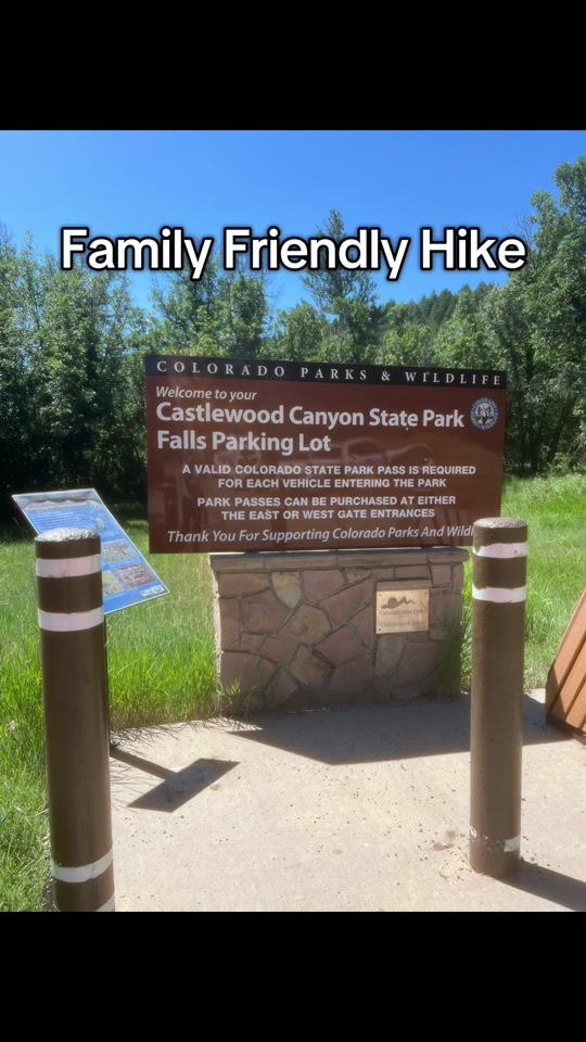
This is a copy is my review for the Homestead Trailhead and the Castlewood Canyon Ruins Loop. To get there, you need to enter the park through the west entrance.
The Homestead Trail will take you through the Lucas Homestead Site. There are a few interesting things to see along here in addition to the home. About .4 miles in the trail will split into the Creek Bottom Trail to the right and the Rim Rock trail to the left. If you only wanted to see the homestead, this is where you want to turn around.
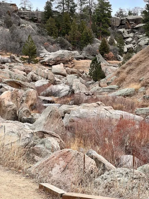
If you want to see Cherry Creek Falls and the Castlewood Canyon Dam Ruins, this is where you start the Castlewood Canyon Ruins Loop. It's a great, moderate hike. Be prepared for some parts where there are lots of rocky steps, but the majority of it is easy going. The Colorado Trail website says it's just under 5 miles, but I think they may measure that "as the crow flies" and that it's longer with all the ascents/descents. We clocked it at just over 6 miles.
The loop! You have a choice to make at the fork... Do you want to start your hike with a steep climb (rock and man-made steps, not literal climbing) up a ridge or do the moderate thing along side a river? Take the Rimrock Trail if you want to start out on the canyon ridge, Creek Bottom Trail to stay in the canyon bottom.
We decided to stay to the right and followed the Creek Bottom Trail. It's a little hilly and rocky in places and it's beautiful as you wind your way through the trees and boulders. Maybe about a mile and a half down the trail, you will come to Cherry Creek Falls. I read something before going that said it's 20 feet. It didn't really look 20 feet, but it's very pretty and I'm terrible at judging stuff like that. There are pictures of it attached to this so you can decide for yourself if you care. Which you shouldn't... because it's about being out in nature and not about judging the adequacy of waterfalls. I'm sure they get enough of that from the other waterfalls.
You'll want to continue south on the trail now until you get to the Dam Trail. It'll be on your right. This will take you up some steep steps to the top of the Castlewood Canyon Dam Ruins. The view to the south from up here is incredible. So much green! Be sure to read the plaque about the dam. It has an interesting story.
Now it's time to check out the other side of the dam and start the ridge portion of the hike. Follow the Dam Trail until it forks. Stay to the left. This is the Rimrock Trail that I mentioned earlier. Get ready for some serious leg exercise... So. Many. Steps... Steep steps... But once you get to the top, you are rewarded with a really cool view of the dam followed by a completely flat 2 mile stroll along the canyon's edge.
Unfortunately, the park rangers lock the gates at dark and you need to be gone before then. Even more unfortunate is that your car is parked in a lot in the bottom of the canyon and you're currently at the top of it. Time for more stairs.
The cool thing about the north part of this trail is that it's not as steep of a climb/descent as the south end. And it's a lot prettier, being surrounded by trees instead of rocks. It can still get difficult in spots though, so watch your footing.
After the trail reaches the bottom of the canyon, it meanders to the west for maybe half a mile before terminating at the intersection of the Creek Bottom Trail, which goes left, and Homestead Trail, which goes right. Unless you want to do the loop again, go to the right. This is the stretch of trail that you started on and it'll take you back to the parking lot.
While you're out there, keep an eye out for deer and other wildlife. We didn't see any, but I would think that the ridge top would be prime real estate for rattle snakes in the summer, so it's always good to be aware of your surroundings. There are also wildflowers and some cacti along the...
Read more