Bender Mountain Nature Preserve things to do, attractions, restaurants, events info and trip planning
Basic Info
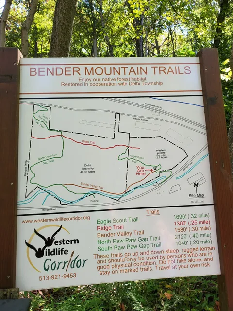
Bender Mountain Nature Preserve
6320-6468 Bender Rd, Cincinnati, OH 45233, United States
4.7(150)
Open until 9:00 PM
Save
spot
spot
Ratings & Description
Info
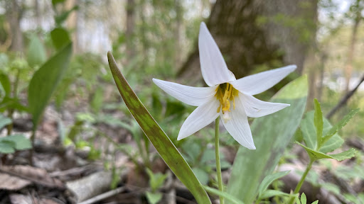
Outdoor
Adventure
Scenic
Pet friendly
Off the beaten path
attractions: , restaurants: , local businesses:
Phone
+1 513-921-9453
Website
westernwildlifecorridor.org
Open hoursSee all hours
Thu6 a.m. - 9 p.m.Open
Plan your stay

Pet-friendly Hotels in Delhi Township
Find a cozy hotel nearby and make it a full experience.

Affordable Hotels in Delhi Township
Find a cozy hotel nearby and make it a full experience.

The Coolest Hotels You Haven't Heard Of (Yet)
Find a cozy hotel nearby and make it a full experience.

Trending Stays Worth the Hype in Delhi Township
Find a cozy hotel nearby and make it a full experience.
Reviews
Live events

Art of the Brick: An Exhibition of LEGO® Art
Thu, Feb 12 • 10:30 AM
18 West 4th Street, Cincinnati, 45202
View details

Resilience in Action
Thu, Feb 12 • 8:00 AM
222 West 7th Street Cincinnati, OH 45202
View details

Hunxho - Madison Theatre
Fri, Feb 13 • 6:00 PM
730 Madison Avenue Covington, KY 41011
View details