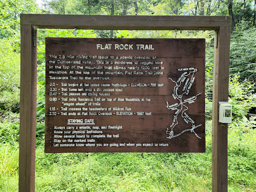
Traveled (day trip) from Lancaster, PA to see flat rock vista. Google Maps took me to a private drive, based on geo location. Pulled over and discovered the trail head is actually at Colonel Denning State Park. Very nice location. Ample parking. Clean. Nice bathrooms, with shower stalls. Well maintained all around. The trailhead was well marked. Blazes were easy to see/locate. The main way to get to flat rock is via a pretty strenuous hike, the majority of which is shaded (at least in mid Summer). Even if you somehow get up the available logging road (there are many trails to get to flat rock, but the main trailhead is near Colonel Denning's camping area), at the pinnacle, you still have to traverse a small boulder/stone field, with uneven terrain. The flat rock trailhead, a few yards in, starts off with some relatively new retaining wall steps. They're well built, but uneven... some steeper than others. If you have knee issues, this (and many portions of the trail) will likely be a problem. Further on the trail, there are two paths... "preferred route" and "challenging." "Preferred" meanders up the mountain side, moreso than "Challenging." There are still some minor boulders/steps on the "preferred" trail. Challenging, which I took at hike in, is more of a shortcut. At first the path doesn't seem hard. It starts out following a steep, but short, logging/access road (you feel misled, like, yeah this is steep, but it isn't challenging). And then you veer off the access road and go up some steep, but traversable boulder/stone steps. My out of shape self was huffing and puffing the whole way up. It isn't impossible by any stretch of the imagination, but those who are out of shape, and haven't hiked in a year, might struggle like I did. At no point was the trail not easily identifiable and not maintained. All trails converge on a flat area with a picnic table (and, eventually, a lean-to, with fire pit and picnic table). From there you hike further ( another mile in all) to get to flat rock), crossing a well-made plank pathway and then up a steeper portion, to eventually hit the boulder bed. Keep going until you reach flat rock. The hike up is hard if out of shape, but is not nearly as hard (for out of shape people, at least) as the portion of the "Challenging" route was. I saw people with big dogs on the trail, but felt bad for the pooches. Some areas can't be good for their paws. Re: bringing kiddos... I saw one family with an 13 year old, resting at the picnic table near the multi-trail convergence. The kiddo looked to be in decent shape but was struggling and didn't want to go further. But, what ~13 year old, short of using electronics, wants to do things willingly? That to say, you know your kiddos and what they can/can't handle. Some kids (and adults) will struggle with portions (some of which are unavoidable) of this trail.
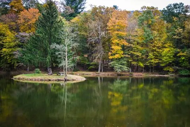
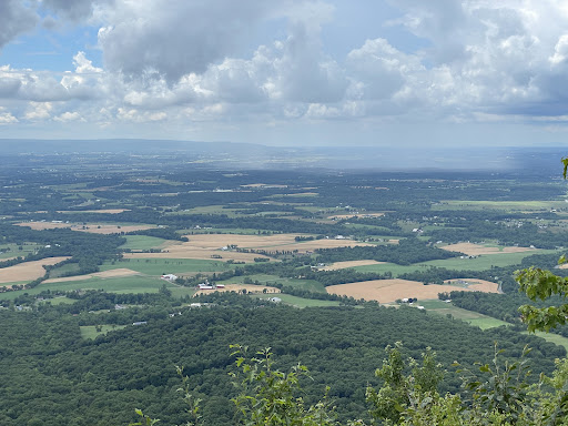
Was it worth it? Absolutely. The view of the valley was breathtaking (after I caught my breath that is)... I can't even imagine what the view would be like in the Fall when there's less foliage to obstruct the full valley view. There are no guard rails on flat rock. So, use good judgement when on flat rock. But it is definitely worth the day trip and something to add to your hike...
Read more