7-10-21
This listing on Google Maps is for the Mayo Mountain Access. So all the reviews/photos talking about the waterfall and river clearly are talking about the Deshazo Mill Access. THERE ARE NO WATERFALLS OR RIVERS AT THIS ACCESS. It boggles my mind that people can't read a map...
This is a lightly trafficked park. It is also one of the most sprawled NC State Parks (Crowder's Mountain and Pilot Mountain are others) where the different accesses are not close in proximity.
There are two main lots as you enter the park. The far left one is the largest (maybe 20 cars) and has a shelter with picnic tables. Bathrooms are close. The middle lot has the bathrooms (maybe 10 parking spots but still close to the shelter), and the far right lot has the office. No parking here but close to the bathrooms as well.
I come for trails and frankly, these are rather ordinary and not something I would go out of my way for. These are accessible by the LEFT lot. Signage here. The Mayo River TRACK Trail (.5 miles, easy, red) and the Mayo Mountain Loop Trail (1.8 miles, moderate, blue) are the only trails in this access. I've only done the Mayo Mountain Loop so here that is. Signs point you to go clockwise. It is clay throughout with roots and some rocks. Mostly even laterally but has some up and down. The first mile or so is a gradual climb and the last .8 miles are a gradual descent. The descent follows the creek on your left. A few periodic bridges. There are .25 mile markers for safety with cell service good throughout. Varying canopy heights and the forest is thin to dense. I usually spot deer here at thinner parts but they never let me get close.
^I've done better trails in local parks and this is an understatement. If you are looking for flowing streams and a waterfall, go to the Deshazo Access. The best thing in this access is the large shelter on the pond. Aside from that, blah.
Not something I would go out...
Read moreGreat waterfall with a short hike. Consider liking my review and pictures and follow along on on my adventures. Get Your Adventure On! Envisioned as a riverine park along the Mayo River from the Virginia state line to the confluence with the Dan River near Madison, N.C., 
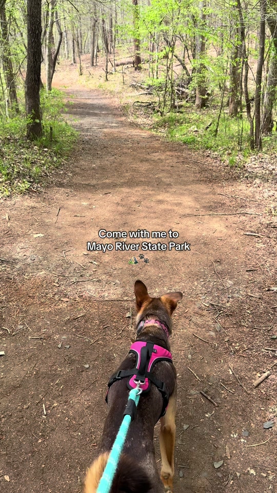
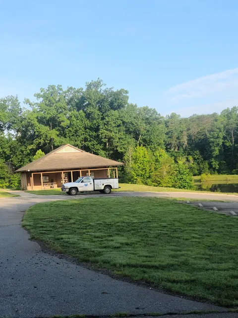
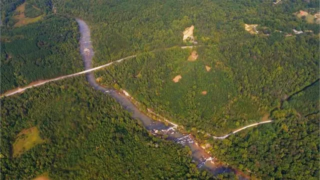
Mayo River State Park is under development but now offers amenities that people have come to expect at state parks. The park covers just over 2,700 acres in several access areas stretching along the 16-mile-long river corridor. The 400-acre Mayo Mountain access serves as the park's interim headquarters. This access features a pavilion-style picnic shelter, a small picnic area, fishing ponds, hiking trails, restrooms, and the park office. Group camping is available for organized groups. The Deshazo Mill and Anglin Mill accesses are each about a 20-minute drive from the park office, and both are accessible from Anglin Mill Road. Visitors to the Deshazo Mill access can picnic or take a short hike to the waterfall on Fall Creek and the northern headwaters of the Mayo River beyond the waterfall. The Anglin Mill access is located on the banks of the Mayo River and provides paddling and fishing access. The Hickory Creek access is located on Tyne Road, a 15-minute drive from the park office. The Mayodan access is a 5-minute drive from the park office and offers access to the last leg of the Mayo River to its confluence with the Dan River. Please contact the park for more information on access areas, upcoming programs and events, group camping, and future park...
Read moreBeautiful park with well maintained trails. The waterfall is very close to the parking lot and easy for the whole family to walk to (only a few steps). Plenty of great water access/swimming spots. I had to knock a star off for a few reasons. There is no map posted and we had no cell service. I think a state park should definitely have a map and clear trail markers. There's a fork in the path once you get to the river, we went right for a long way but the trail seemed to keep going even though the trail markers stopped. So we were confused on whether we made it to Byrd's Ledge or not. And where did the left path go? If we didn't have our toddler with us we may have spent more time figuring it all out. Also, there is one Google Maps location that will take you to a random dead end over 20 minutes from the actual park entrance. Make sure you go to the location off of Anglin Mill Rd. Parking is limited but we had no trouble getting in and out. Also, is there an old mill to see? I'll have to research this spot more before we go back. It was...
Read more