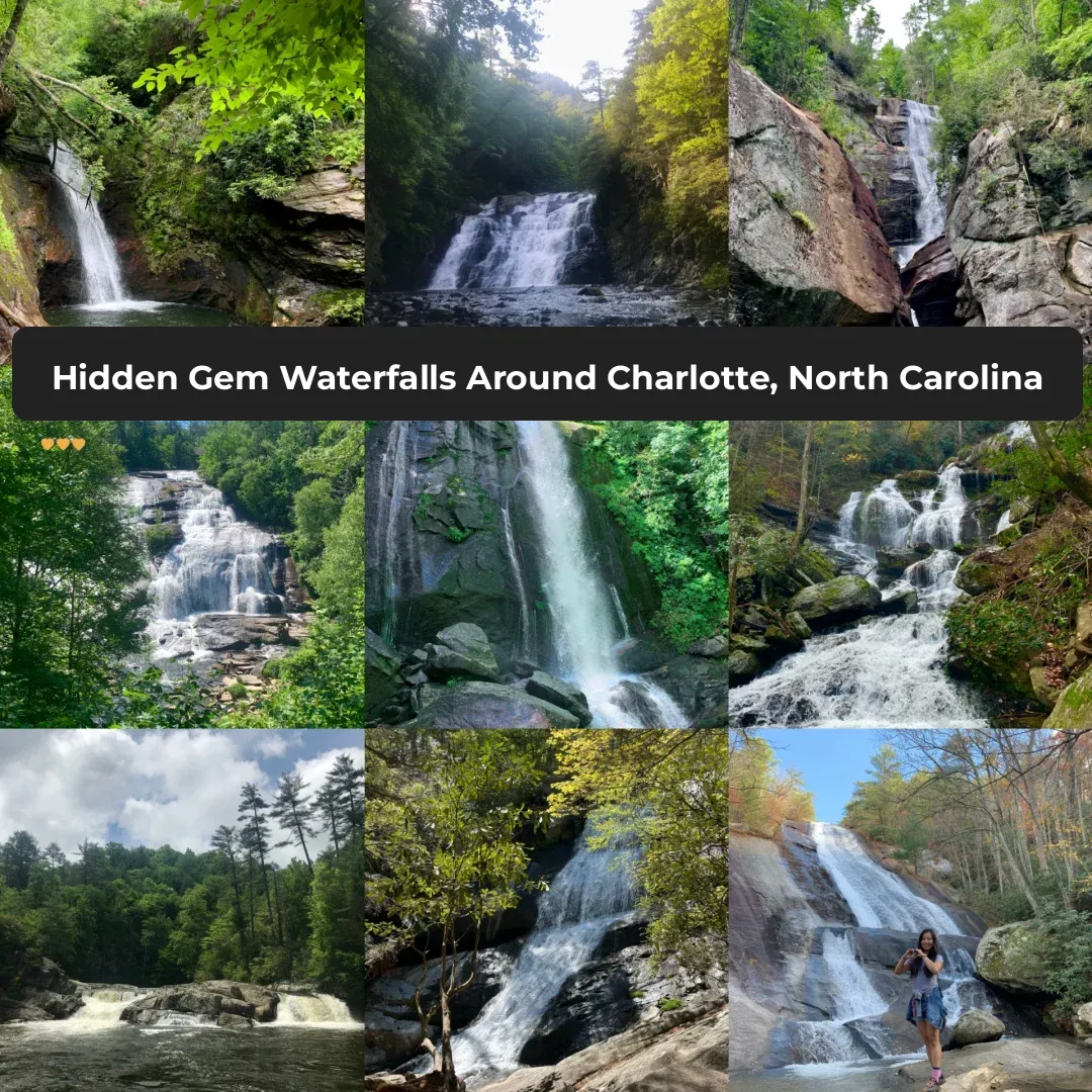
Upper Creek Falls things to do, attractions, restaurants, events info and trip planning

Basic Info
Upper Creek Falls
6118 Wind Song Ln, Newland, NC 28657
4.8(225)
Open 24 hours
Save
spot
spot
Ratings & Description
Info
Outdoor
Adventure
Scenic
Family friendly
Pet friendly
Off the beaten path
attractions: , restaurants: , local businesses:
Phone
(828) 257-4200
Website
fs.usda.gov
Plan your stay

Pet-friendly Hotels in Newland
Find a cozy hotel nearby and make it a full experience.

Affordable Hotels in Newland
Find a cozy hotel nearby and make it a full experience.

The Coolest Hotels You Haven't Heard Of (Yet)
Find a cozy hotel nearby and make it a full experience.

Trending Stays Worth the Hype in Newland
Find a cozy hotel nearby and make it a full experience.
Reviews
Live events

26 Soup & Bowl Benefit
Sun, Feb 22 • 12:00 PM
6751 North Carolina 126 Nebo, NC 28761
View details
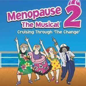
Menopause The Musical 2 at COMMA Performing Arts Center
Tue, Feb 24 • 7:30 PM
COMMA Performing Arts Center, 401 S. College Street, Morganton, NC 28655, United States
View details

Avery LTRG Resource Fair Series: Newland
Tue, Feb 24 • 3:00 PM
661 Vale Road Newland, NC 28657
View details