Mt. Kaʻala Hiking Trail things to do, attractions, restaurants, events info and trip planning

Basic Info
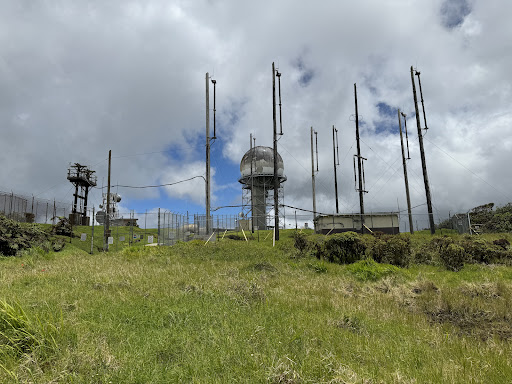
Mt. Kaʻala Hiking Trail
FRGX+44R, Waianae, HI 96792
4.5(92)
Open until 12:00 AM
Save
spot
spot
Ratings & Description
Info
Outdoor
Adventure
Scenic
Off the beaten path
attractions: , restaurants: , local businesses:
Website
noahlangphotography.com
Open hoursSee all hours
SunOpen 24 hoursOpen
Plan your stay

Pet-friendly Hotels in Oʻahu
Find a cozy hotel nearby and make it a full experience.

Affordable Hotels in Oʻahu
Find a cozy hotel nearby and make it a full experience.

The Coolest Hotels You Haven't Heard Of (Yet)
Find a cozy hotel nearby and make it a full experience.

Trending Stays Worth the Hype in Oʻahu
Find a cozy hotel nearby and make it a full experience.
Reviews
Live events

Explore a tropical fruit and citrus farm
Fri, Jan 30 • 9:00 AM
Haleiwa, Hawaii, 96712
View details

Luxe Yacht Sunset Sail - Small Group
Tue, Jan 27 • 4:30 PM
Kapolei, Hawaii, 96707
View details
Luxe Yacht Sunset Sail - Small Group
Mon, Jan 26 • 4:30 PM
Kapolei, Hawaii, 96707, United States
View details