Jan 2023 Olomana Ridge complete review!
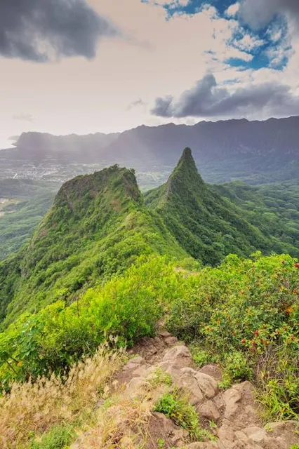
Nutshell: This is a increasingly steep climb, a real leg burner workout to get to the top, but views are incredible if you can get past last 200 feet of exposure at end.
Parking: You need to walk 3/4 of a mile to get to the trailhead. Thats a fact. No closer parking, or you will get towed. I parked on the side of the road by the Anglican Church on Auola Rd (opposite the bus stop). Lock vehicle, and hide or take valuables with you, area is known for crooks breaking windows if they see something they want.
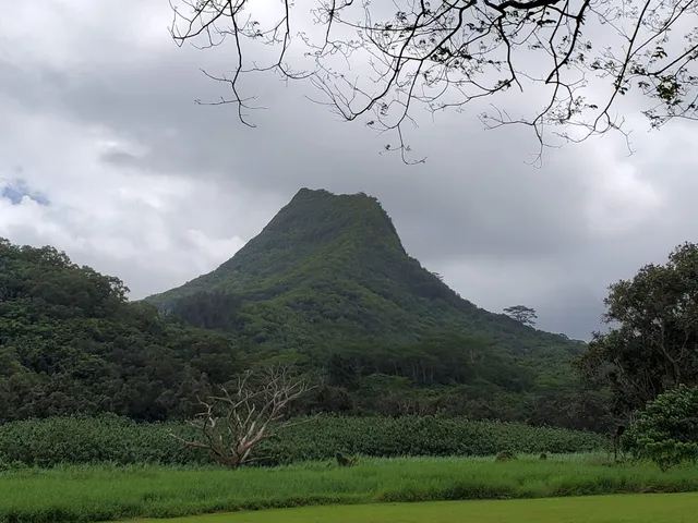
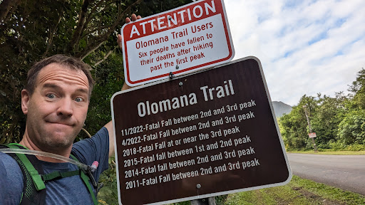
Walk to Loop Road, and its goes into the Golf Club. Ignore all the "no trespassing" signs, you are allowed to walk this route to get to the trailhead. Go past the gate and booth, and trailhead will be on your left. Cant miss it. Has a sign that talks about all the people that died there (see sign in my pics).
Bring water, you will need it I went through about a liter in my camelback (recommended, since you need both hands for this climb)!
Hike is very shaded, and starts off easy and gradually getting harder. Starts with many exposed roots and rocks. Graduates to a soft pine needle trial, and then red clay trail, and then rocky trail, and eventually just rock!
I'm a 40 year old, slightly above average fitness level, and it was still a leg burner. I was clipping along at a pretty quick pace, and it took me about 50 minutes from car to get to peak #1. I spent 10 minutes on the last 200 feet, due to exposure.
You can't really get lost, there are no signs on trail, but it is very well traveled. I started at 7:30am, and had maybe 5 people in front of me, and passed about 10 people going up, whilst on the way down
There are some sections near the very top that hikers have placed ropes to help you ascend and descend, I did not need to use the ropes, but they would have made it easier. Test ropes first, never blindly trust a used rope!
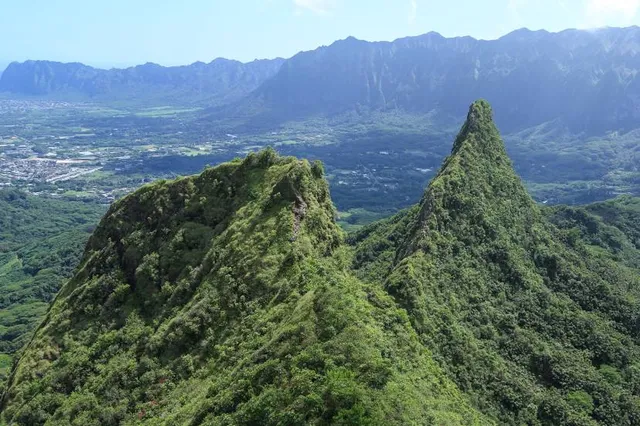
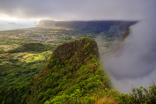
Very limited exposure until you start reaching the top. Then you definitely will have exposure to the open cliff side, knife edges walking on the ridge, wind, etc.
Peak #1 is where most people stop, and continuing on means descending down trail #2 which is harder, and #3 is harder yet, though I did not personally try these ones. I felt the view from #1 was perfect, and didn't want to risk an accident
I am not a fan of exposure, and really was testing myself on purpose doing this hike. I am so glad I did. Totally worth it. The view from peak #1 is awesome. I sat up top by myself for 30 minutes enjoying God's handiwork, and also the helicopter tours going just over my head. I think they enjoyed waving at me and me waving back. If a helo tours fly by you when hiking, you know you are in a beautiful spot
I tried to post pics during the hike, some landmarks, and sights you should know, so you can get an idea of what its like to decide if this is for you. No pets, and I would not recommend this for children, especially the crest of peak #1. Its not as bad as some other reviewers are making this sound. Go for it!
Hope this helps anyone thinking...
Read more