Steinhatchee Falls things to do, attractions, restaurants, events info and trip planning
Basic Info
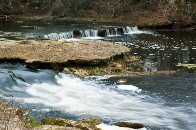
Steinhatchee Falls
Steinhatchee, FL 32359
4.5(253)
Open 24 hours
Save
spot
spot
Ratings & Description
Info
Steinhatchee Falls and Steinhatchee Rise are tracts of protected lands in Florida named for aquatic features. Steinhatchee Falls includes 1,766 acres, and Steinhatchee Rise covers 3,559 acres. Steinhatchee Falls is in southeastern Taylor County, Florida. Steinhatchee Rise is in southwestern Dixie County, Florida.
Outdoor
Scenic
Adventure
Pet friendly
Family friendly
attractions: , restaurants: , local businesses:
Phone
(386) 758-0525
Plan your stay

Pet-friendly Hotels in Perry
Find a cozy hotel nearby and make it a full experience.

Affordable Hotels in Perry
Find a cozy hotel nearby and make it a full experience.

The Coolest Hotels You Haven't Heard Of (Yet)
Find a cozy hotel nearby and make it a full experience.

Trending Stays Worth the Hype in Perry
Find a cozy hotel nearby and make it a full experience.