Door Bluff Headlands County Park things to do, attractions, restaurants, events info and trip planning

Basic Info
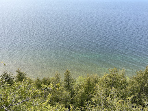
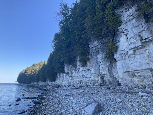
Door Bluff Headlands County Park
12900 Door Bluff Park Rd, Ellison Bay, WI 54210
4.6(265)
Closed
Save
spot
spot
Ratings & Description
Info
Outdoor
Adventure
Scenic
Pet friendly
attractions: , restaurants: , local businesses:
Website
co.door.wi.gov
Open hoursSee all hours
Wed8 AM - 8 PMClosed
Plan your stay

Pet-friendly Hotels in Town of Liberty Grove
Find a cozy hotel nearby and make it a full experience.

Affordable Hotels in Town of Liberty Grove
Find a cozy hotel nearby and make it a full experience.

The Coolest Hotels You Haven't Heard Of (Yet)
Find a cozy hotel nearby and make it a full experience.

Trending Stays Worth the Hype in Town of Liberty Grove
Find a cozy hotel nearby and make it a full experience.
Reviews
Live events

Billy Dave Live!
Thu, Jan 29 • 5:00 PM
10339 HWY 57, 54234, 10339 WI-57, Sister Bay, WI 54234-9280, United States
View details