Eagle Mountain Trailhead things to do, attractions, restaurants, events info and trip planning

Basic Info
Eagle Mountain Trailhead
Grand Marais, MN 55604
4.8(105)
Open until 12:00 AM
Save
spot
spot
Ratings & Description
Info
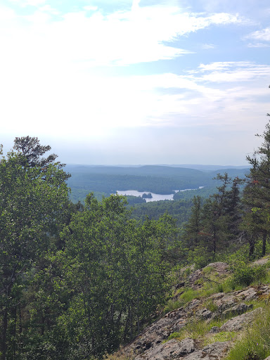
Outdoor
Adventure
Scenic
Pet friendly
Off the beaten path
attractions: , restaurants: , local businesses:
Website
highpoint.guide
Open hoursSee all hours
FriOpen 24 hoursOpen
Plan your stay

Pet-friendly Hotels in West Cook
Find a cozy hotel nearby and make it a full experience.

Affordable Hotels in West Cook
Find a cozy hotel nearby and make it a full experience.

The Coolest Hotels You Haven't Heard Of (Yet)
Find a cozy hotel nearby and make it a full experience.

Trending Stays Worth the Hype in West Cook
Find a cozy hotel nearby and make it a full experience.
Reviews
Live events

Poplar River Condos Weekend Ski Shuttle
Sat, Feb 21 • 9:15 AM
580 Poplar River Road Lutsen, MN 55612
View details