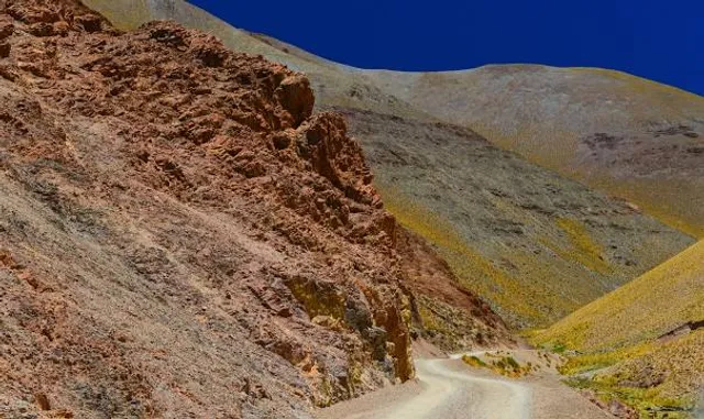
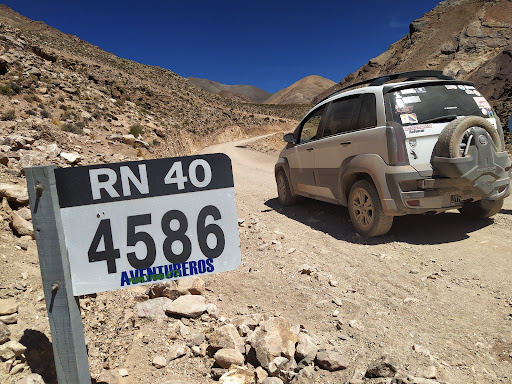
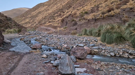
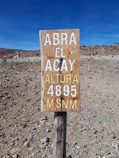
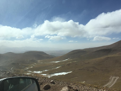
Fuimos en un Fiat idea adventure en noviembre 2021. Las distancias no se miden por km, sino por tiempo. Salimos de La Poma a las 9:30, horario que nos recomendó la Policía. Hay que registrarse antes de salir, ellos calculan aprox 2.30 hs. Nosotros tardamos 4 hs. Al llegar a San Antonio de los Cobres hay que avisar que llegaron. El camino es de un buen ripio. Al principio es ancho y a medida que vas subiendo se angosta y se hace un poco más difícil por las curvas, algunas muy cerradas. Hay que tocar bocina por si viene alguien de frente y no lo ves. Es un camino de cornisa. Se cruza el río en varias oportunidades. A veces es un hilo de agua, otras es más extenso. Hay que poner piedras en la salida del río porque suele estar poceado, ahuellado. Ésa fue la mayor dificultad que tuvimos. Hay que ir despacio y con precaución, en las bajadas ir con el cambio. Al llegar a un lugar llamado Negra Muerta, te encontras con una señora con dos chiquitos que venden artesanías. Ahí suspira!! Ya pasaste lo más difícil. El camino es hermoso por dónde lo mires!! Y cambia constantemente!! Cada vez que bajes del auto hacelo despacio. No hagas movimientos rápido para evitar apunarte. DISFRUTA Y VIVÍ UNA EXPERIENCIA GENIAL!!! Y NO TE OLVIDES DE AVISAR QUE LLEGASTE!!! porque sino sale la policía a buscarte !! ALGO SUPER IMPORTANTE!!! NOS DIJERON QUE LOS MEJORES MESES PARA CRUZAR EL ACAY ES DE SEPTIEMBRE A DICIEMBRE/ENERO. porque después comienza la época de lluvia y el río baja con caudal y se desprenden las piedras. A partir de abril, se congela!! Siempre antes de ir consultar si hubo lluvias. Si el río se ve con agua turbia, es porque está crecido!!! Y cruzarlo se hace difícil porque está lleno de piedras!!! DETALLES IMPORTANTES!!! lo ideal sería de San Antonio de los Cobres a La Poma. Porque cruzar los ríos sería en bajada. Averiguar si es época de lluvias. Y TOMAR MUCHA MUCHA MUCHA AGUA DESDE EL DÍA ANTERIOR. ÉSO TE AYUDA POR LA FALTA DE OXIGENO EN ALTURA!!!! Otra cosa muy importante!!!!!! En el camino, en el medio de la nada, por ejemplo en La Poma, Palermo, Pueblo Viejo, veiamos a la gente utilizando el teléfono. Nosotros tenemos PERSONAL y no había nada nada de señal. PORQUE LA ÚNICA EMPRESA DE TELEFONÍA QUE FUNCIONA...
Read more