Wow it feels like only yesterday when I summitted Mt Toolbrunup on the New Year's Day on 1st Jan 2023. And look where we are now!!! Just a few more days and we'll be in 2024!!! 😱 How scary time flies! 😱 Anyway, the almighty Mt Toolbrunup was my 5th mountain in my favourite national park. A mountain with a reputation 😁 I was so happy and elated when I reached the top on new year's day. I thought - WOW what a way to start a new year! The moment I was up there, I was just so overwhelmed and emotional. I cried happy tears and I prayed! Yes you read it right, I prayed and say thanks and made wishes 🙏 l was so in awe of the VIEWS. Out of all the peaks, Mt Toolbrunup is the MOST BEAUTIFUL! JUST BEAUTIFUL! The wildflowers...OMG THE WILDFLOWERS! 🌺🌸⚘️🌸💐🌻🌼🌹🌾🍀☘️⚘️🏵💮 Who would have thought! It looked just like a garden in wilderness that I had to stop a thousand times to take pictures 😁 I've done most peaks in Stirling NP and I'm glad I saved the best for the last.
I won't talk about all the details of the climb. I'm a firm believer in experiencing something by actually doing it. So you just gotta climb it to see and feel it all. It's a grade 5 hike that fits the bill so it's certainly not a walk in the park. As long as you're fit and have some hiking experience, you should be fine. The hardest part is also the most beautiful part that requires steady legs and strength (esp when coming back down 😵💫). Just remember to look up every once in a while and enjoy the views and also look back to see how far you climb up. Is Toolbrunup safe to hike alone?? Absolutely! Obviously most ppl hike with a friend as a recommended practice. However, I did it all solo and I was fine and had a fantastic time. So it all comes down to the individual and their own assessment of ability and experience.
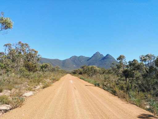
Mt Toolbrunup also taught me a lesson - DON'T LIVE YOUR LIFE IN FEAR. You see, before I tackled it, I have heard and read all sorts of things about this mountain 😬 I always travel and hike alone and never had any issue. But Mt Toolbrunup felt very different to me. It looked intimidating and confronting. I remember when I summitted Mt Hassell that looked straight ahead to Mt Toolbrunup, I thought to myself - 'Errr idk if I could climb Mt Toolbrunup by myself 😵💫'. This was why I purposely left it to later becos I thought I better slowly built up my hikes from the easiest, which was Mt Trio, then up to the next one Mt Hassell, then Mt Talyuberlup and at last Mt Toolbrunup (I've already done Bluff Knoll a few times). And I think this strategy helped me in managing my fear and doubt as I slowly built my courage and confidence. I also happened to meet a girl from Sydney visiting Perth who climbed Toolbrunup solo!!! I was amazed when she said that. So I told myself 'Well if she could do it, then I can do it!' And that I did!!! Woohoo! 💪
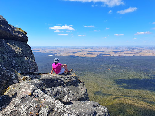
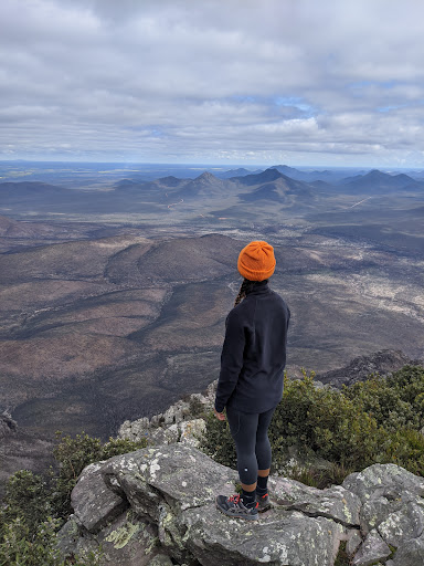
The day I climbed Toolbrunup, the weather was just absolutely perfect. In fact I think it was the bestest weather I've ever had from all my countless visits to this beautiful national park. Although it's in Jan, it wasn't hot at all and there's no wind whatsoever either when I got to the top, which was such a rarity cos every peak I had been, it's always windy. There were a few other climbers, but due to my slower pace, I was very lucky to end up having the summit all to myself for a while 😁 so I had some time to just soak it all in and enjoy the humbling silence before I was joined by a couple of hikers. There were proper signages but do be aware: it's still very easy to get lost. That's what happened to those 2 hikers coming down, but thankfully they found their way back albeit through the bushes 😆 I believe that's what happened too in the incident in Jan 22 where sadly someone died.
So there you go. I'm sure I'll come back one day and hike Toolbrunup again. This is definitely my most favourite peak out of all. Happy adventuring! Get out there and see what we have in our own backyard. Be safe and be responsible. And remember to smell the roses along the way 🥰 (PS: Don't wear...
Read more