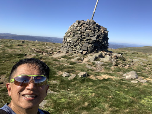
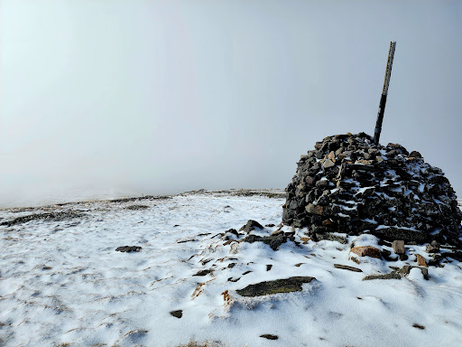
Reached Summit via Staircase spur and down via Eskdale Spur in a total of 5hrs. Conservative 3hrs ascend and speedy 2hrs descend.
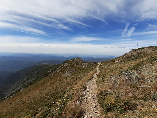
Way up is full of continuous climb until you reached the open area; it’s ok to pause and catch a breadth. Do snack along the climb so that you have energy to pace yourself. The final ascend near the summit has some steep climb on both Staircase and Eskdale spur(especially the latter). Once you’ve cleared that part, the final steps to the summit is a walk in the park. The top area has very gentle slopes.
Warning about Eskdale Spur. If you are descending and making your way back to Staircase spur start point/mountain Creek Panic area, the sign at the bottom or start of the Eskdale Spur pointing to the way back to Staircase spur is gone. To the left of where you climb down from is a small path that descend further down, take that. Do not go the wide path straight ahead(used by 4-wheel drive) that slopes up.
Also, the path back from Eskdale Spur start point to Staircase Spur start point can be narrow initially and there are some fallen trees along the way that at one point might “hide” the path. Don’t panic, it just split the path and all you need to do is look and climb over that section of then fallen tree the other side; easy peasy.
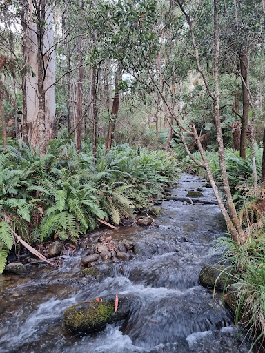
That’s not all, there are creek crossing without bridges! I recall at least 3 and one of them is a little wider (3-5m) with constant flowing stream. It’s not very deep but if you were to step in, your shoes would be totally wet and there are at least another 1-2hrs of walk left. Fortunately, there are rocks outcrops on the creek that you could step on to make your way across but be prepared to make a few jumps and be very careful as those rocks are very slippery.
If you are uncomfortable with the risk involved with above path back, I would suggest returning to the panic area via the same way up (I.e Staircases Spur). If you choose this way, I do suggest walking over to the final ascend of the Eskdale Spur and look at the shear beauty of that very steep section; it’s just about 100m from the path split of the Staircase spur.
Ration wise, I carried about 3L of water but used only 2L as the bulk of staircase Spur is shaded unlike Mt Feathertop which is mostly exposed walk and you needed more water.
Food: ate 4 small choc croissant. Brought trail mix nuts but didn’t eat any. So you don’t have to carry too much for this climb.
Start your climb early to minimise the effect of heat if you are climbing in summer. I started at 6am and it was 12 deg(not that cold) and when I reached the summit, it was also 12 deg. Perfect.
Attire: long sleeves non-cotton for sun protection and comfort. I had a Macpac powerdry type and it was perfect. I wore trekking pants though shorts would do the job too. Reason for long is for sun protection and bush bashing protection too. Hat (with hanging side and back cover) is highly recommend or wide brim is also a good option.
Sunnies are highly recommended as it minimise heat fatigue too.
Summary: Bogong is tough but manageable. High level of Fitness is recommended but you can still do it if your fitness is regular. Just allocate more time for the climb (9-10hrs) and take regular breaks to catch breadth and rest your muscle
Remember, reaching the summit is one thing, making it down safely is another. If you legs are already wobbly by the time you reached the top, they wouldn’t be able to safely carry you back down the very steep path. Some sections are so steep and precarious that if you slipped, that would probably be the last of you.
Respect the mountain, others and...
Read more