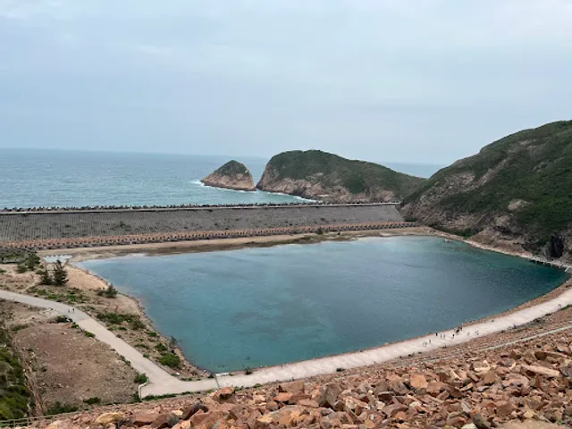
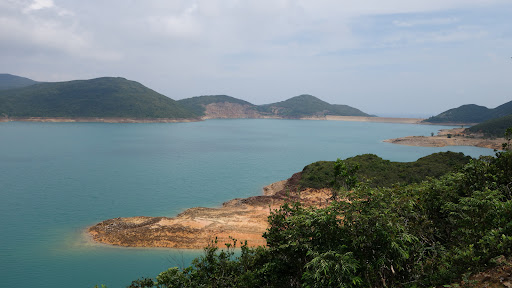
High island Reservoir,Saikung, NT
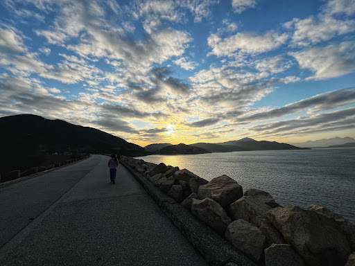
We walked around the embankment -Maclehose trail Sec one of this High Island Reservoir (Chinese name :-Van Yee) leading to the famous Geopark of HK at the High Island Reservoir EAST Dam. We started from Tai Mong Tsai Road , Fat Kee Store near Pak Tam Chung. The day we walked was on 23 September. Even with a cloudy sky , we got a lot of the sun and without knowing ,got a bit of sunburn as it was an open road. The whole to and return trip’s time for the route took us 5 hours at our normal walking speed, the return trip was by Taxi.
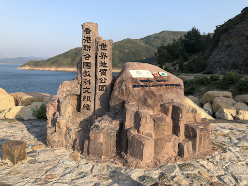
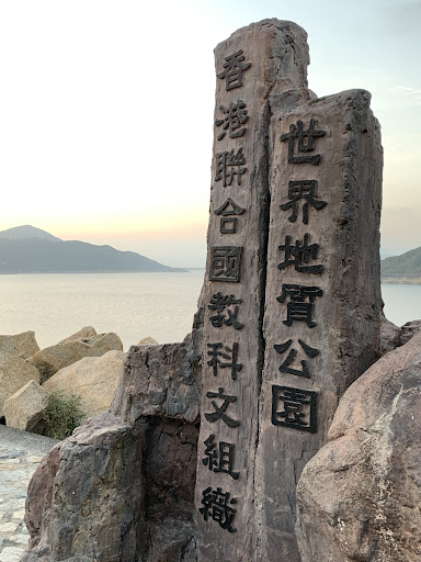
Along the walk from Fat Kee Store to the East dam ,we discovered many points of interest:- such as HK adventure Corps camp site, Astro park, Chong Hing Watersport Centre, High Island Reservoir West Dam, Pak Lap Camp Site, High Island Reservoir Monument.
The total distance from the starting point store, to the park is 9.5 Km. If one returns to the starting point again ,it will mean travelling 19 km of hiking. The road is basically wide and on paved concrete without much gradient. The total ups and downs travels are about 154 meters up and 100 meter down . So it is good family walk with a caution that between the High Island Reservoir West Dam to the High Island Reservoir Monument point at the last stretch of 4.5 Km is a long walk of about meters an elevation of 30 M. This is particularly strenuous because it will be most likely to be feeling tired when one is close to the end of the 9.5 Km.
It is recommended to take an umbrella and hat and sunglasses, wearing long sleeves shirt , in any weather , to walk here. It is also advisable to walk this route during Autumn as the sun is mild and temperature will be low with changing colours of the leaves which will add to the beautiful sceneries of open road and vast reservoir - a rare vastness of space in the environment of HK.
It is better to walk the 9.5 km instead of a round trip 19.00 Km. If one takes this mode , one can go to the end of the route at High Island Reservoir East Dam from Sai kung by taxi and walk back to the starting point Fat kee Store where Public transport is available .Or ,in a reverse manner, walk to the East Dam and take a taxi or minibus back( available at 1530 at public holidays). The first method is recommended as it gives the visitor a lot of time to take in the beautiful sceneries and walk a bit around the East Dam to appreciate the hexagonal columns of rock columns, from Volcanic action and the big human structures along the beach and the nearby sea cave and Po Pin Chau ( island split into two by the action of waves).
It is a good location to study the geological formation of billion years ago and to take photos of the beauty of nature.
More than greater half of a day is required and dried rations is necessary. Not the least is a lot of water. There are many call taxi stations but not all are responsive. I gave the one I used-Taxi Association Number 23830168 (Note:- I have no connection with this association but given for helping infrequent users of call taxi which may be difficult , in this remote area). The taxi fare is about HKD130/one way.
written on 7th...
Read more