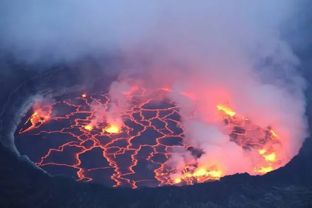
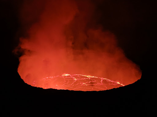
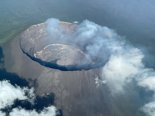
In August this year I visited the Nyiragongo volcano in the Democratic Republic of Congo. This volcano hasn’t had a regular outbreak since 2002, but it has an exciting lava lake within its crater.
The summit of Mount Nyiragongo is located about 20 km north of Lake Kivu and the city of Goma. The elevation of Lake Kivu is 1460 metres above mean sea level. To get to Nyiragongo you need to book a volcano trek with the Virunga National Park, and there’s also a fee to pay for a permit to climb the mountain. The starting point of the trek is Kibati Station, a ranger station within the park, somehow located at the foot of the mountain, at an elevation of about 1995 metres; and only about half an hour’s drive from Goma. The track from Kibati to the top is 7.8 km, and the crater edge is located at an elevation of 3470 meters; thus you have a quite steep climb of almost 1500 vertical metres to get there. In addition, the altitude ensures the air that you breathe while climbing is quite thin; so don’t embark on this trek unless you’ve trained sufficiently in advance of your journey.
For the trek you may bring your own food, or you may include a small, medium or large food package in your booking with the park. Likewise, you may bring your own equipment, or you may rent a backpack with jacket, raincoat, sleeping bag etc. from the park. Accommodation in a shelter at the top is included, and if needed, you may hire a porter for an additional cost.
We started from Kibati at 10:30 a.m., and followed a forest track in a northwest direction. The ground on which we walked was volcanic for the entire climb. Initially it was black lava soil that was quite OK to walk on. Higher up it was loose stones of solidified lava that tended to roll under your feet, and made walking a bit more tricky; and in the upper part it was lava rock that wouldn’t roll away under you, but tended to be a bit slippery, especially when wet. Five stops were scheduled for food and rest during the climb.
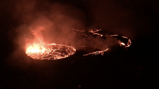
At an elevation of about 2700 metres, we passed the crater of Shaheru, and older volcano that is interconnected with Nyiragongo, and shortly after we came to a large fissure in the mountain side of Nyiragongo; the eruption site of 1977 and 2002. The fissure was created back in 1977 as lava melted its way through the mountainside, the mountainside being solidified lava of about the same composition as the fluid lava. The fissure is quite fascinating, and there was steam coming out of it; but the park rangers told us it isn’t possible to walk through it into the crater. In 1977 lava emerging from the fissure was flowing down towards Kibati, whereas in 2002, I was told, part of the lava stream found its way into the Shaheru crater, melted its way through that crater, emerged through another fissure on the southern slopes of Shaheru, and found its way to Goma, where it buried a large part of the city. Currently, the surface of the lava lake in Nyiragongo is safely below the mountainside fissure, but no one can really predict when the lava level will increase again, and make another eruption inevitable.
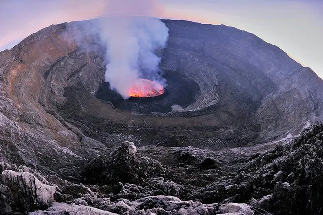
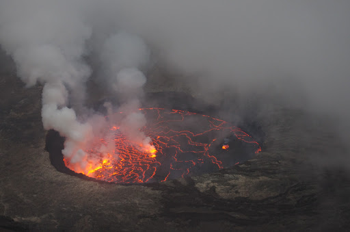
We arrived at the crater edge at early twilight, and right away I shot a few pictures of the lava lake and of my wife standing on the edge of the crater. Less than five minutes later, however, the view of the lava lake was closed by dense clouds that covered the crater, and the walls of the crater are so steep, that you can’t climb down into the crater, unless you acquired a special permit from the park authorities and also brought with you some advanced climbing equipment. There is a small risk, that you may climb Nyiragongo just to encounter a view totally obscured by clouds. The problem is not just vapor from the volcano, as that blows away whenever it’s windy. The big problem, unless it’s dry season, is adiabatic cloud formation caused by humid air from Lake Kivu or from the rain forest when it hits the mountain. These clouds don’t blow away; they increase with...
Read more