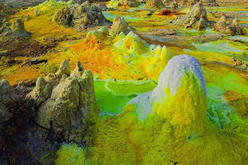
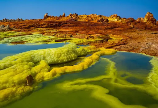
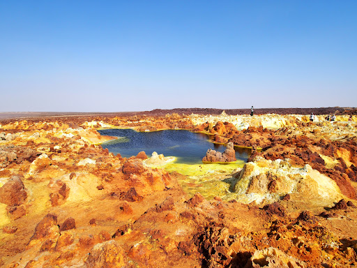
تعتبر “صحراء داناكيل”، الواقعة في شمال شرق إثيوبيا، أنها أقسى مكان على وجه الأرض وذلك للعوامل البيئية الصعبة والغازات السامة المنبعثة من الحمم البركانية ومن شدة قسوة هذه المنطقة سميت بالجحيم على الأرض. وتعتبر هذه الصحراء من أكثر الصحاري في العالم صعوبة وجفاف وأشدها من حيث المناخ الحار الذي لا يحتمل حيث تصل درجات الحرارة إلى 50 درجة مئوية والملوث بالغازات السامة بسبب وجود البراكين الثائرة دائماً والبحيرات الكبريتية التي يتصاعد منها روائح تزكم الأنوف حيث يقع بها براكين تعد الأشهر في المنطقة مثل بركان Erta و بركان Dabbahu. في منطقة داناكيل، لا يوجد شيء من الحياة العصرية، لا كهرباء ولا ماء ولا طرق ولا مبان ولا فنادق ولا بيوت، باستثناء أكواخ العفاريين الذين يعملون في مقالع الملح وأصحاب القوافل.
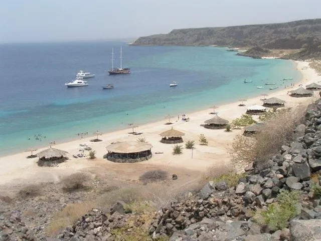
The Danakil Desert is a desert in northeast Ethiopia, southern Eritrea, and northwestern Djibouti. Situated in the Afar Triangle, it stretches across 136,956 square kilometres (52,879 sq mi)[citation needed] of arid terrain. The area is known for its volcanoes and extreme heat, with daytime temperatures surpassing 50 °C (122 °F). Less than an inch of rainfall occurs each year. The Danakil Desert is one of the lowest and hottest places on Earth. It is inhabited by a few Afar, who engage in salt mining.
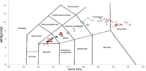
Local geology is characterized by volcanic and tectonic activity, various climate cycles, and discontinuous erosion. The basic geological structure of this area was caused by the movement of tectonic plates as Africa moved away from Asia. Mountain chains formed and were eroded again during the Paleozoic. Inundations by the sea caused the formation of layers of sandstone, and limestone was deposited further offshore. As the land rose again, further sandstone formed above the limestone. Further tectonic shifts caused lava to pour out of cracks and cover the sedimentary deposits.
The Danakil Desert has a number of lakes formed by lava flows that dammed up several valleys. Among these is Lake Afrera, which has thick saline crusts on its banks. The area is flanked toward the east by the Danakil Alps, a tabular mountain system that has a few volcanic cones which peak in height in Mount Ramlo (2,130 metres (7,000 ft)). A deposit of salt up to 800 metres (2,600 ft) thick can also be found in the Salt Plain flatlands. Other local lakes include Lake Asale (116 metres (381 ft) below sea level) and Lake Giuletti/Afrera (80 metres (260 ft) below sea level), both of which possess cryptodepressions in the Danakil Depression. The Afrera contains many active volcanoes, including the Maraho, Dabbahu, Afdera...
Read more