A great hike with some beautiful views. I was unable to complete it due to an absolutely incompetent guide (see below) and some rain that discouraged me from completing the ascent at around 4am. With a moderate fitness level, this climb should be doable. If ascending alone, wait till there is light, with a COMPETENT guide, it should be doable before sunrise.
The best stories in life come from the most epic moments or the most spectacular failures. I arranged to do the Inerie sunrise hike with a guide Edwin, who was recommended by my homestay. I met him the day before and he seemed like a nice enough guy. He was on time and picked me up at 1:45am. It took about about 20 minutes to scooter to the trail head. While I was on the bike, he said that he didn't get enough sleep because he was up drinking arrack.... Giant red flag, I should have asked him to turn around right there.
He didn't bring walking sticks or head lamps, as he had agreed to the evening before, but anyhow, the hike began ok, using just my phone's flashlight. After about 10 minutes of walking, Edwin needed a break. He struggled a lot. We continued along, but about 20-30 steps and then he would need a 3-4 minute break. At 3am, he told me that I should continue alone. He said he was out of breath and couldn't complete the hike, but that the trail was easy enough to follow.
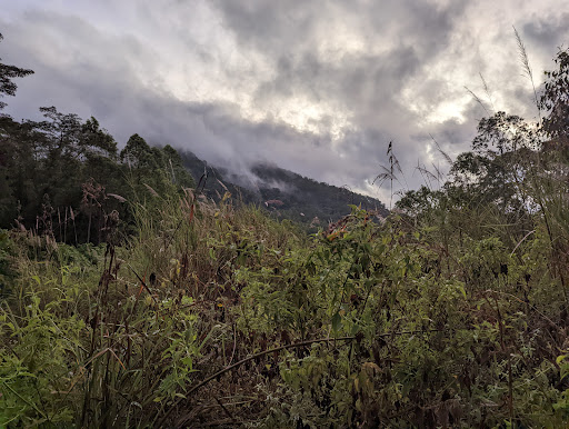
Boy was I an idiot, I should have called it a night and just gone back to bed... Anyways, I continue along, the next 30 minutes of the hike are through thick vegetation with a moderate incline. I have a moderate degree of physical stamina and had no issue at all with this. After about 1-1.5km, the trek became steeper and there was basically no vegetation, just lots of rocks. It continues to progressively gets more difficult. The "path" is difficult to follow at times as there was a loooot of mist/fog and the terrain becomes less hospitable as you ascend. At about the 2-2.5km mark the terrain becomes just volcanic rocks which are EXTREMELY slippery.
At 4:15 it started to rain, and rain hard. I decided to get to a spot where I could at least sit down and wait out the rain. According to google maps, I was approximately 2/3 of the way to the top. Up till then I hadn't needed to take any breaks, the climb was completely doable. The rain continued for 15 more minutes and then I tried to continue my ascent. After about 5-10 minutes of slipping and falling I decided to cut my losses and head back.
Going down was considerably more challenging than going up. The rocks are very very slippery, particularly right after the rain. It took about 2 hours to get down with lots of stumbling along the way. An hour into my descent, I caught back up with Edwin, he apologized profusely and begged me not to mention any of this to the homestay owner, lolol... He was penitent enough, but the whole experience was utterly unacceptable.
We would have finished the descent sooner, but Edwin "lost his pants," as he apparently got too hot to wear his trousers at one point and took them off. Absolutely ridiculous. We wasted 15 or so minutes frivolously looking for his pants to no avail... A very disappointing experience overall, but I'm happy to be back at the homestay and in bed.
Some notes:
BE CAREFUL. Hire a competent guide, the path is not that easy to assess on your own, especially in the dark
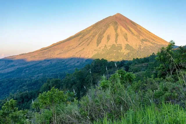
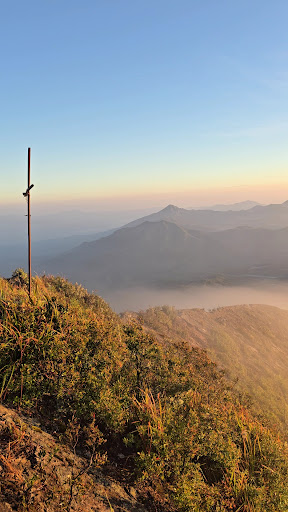
The volcano is beautiful!! You are rewarded with great views even at the base.
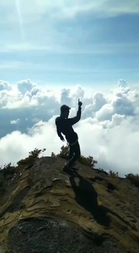
I imagine the final push to the summit is more challenging, unfortunately I didn't feel safe enough to go for it.
Telekom has 4g LTE coverage for the entirety of the part...
Read more