Mount Tateshina things to do, attractions, restaurants, events info and trip planning
Basic Info
Mount Tateshina
Ashidahakkano, Tateshina, Kitasaku District, Nagano 384-2309, Japan
4.5(251)
Save
spot
spot
Ratings & Description
Info
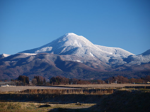
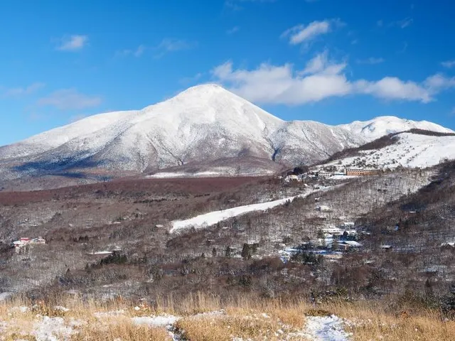
Mount Tateshina also Suwa Fuji is a complex volcano located on the border of the municipalities of Chino and Tateshina in Nagano Prefecture, Japan. It has an elevation of 2,530 m. This mountain is one of the 100 Famous Japanese Mountains.
Outdoor
Adventure
Scenic
Off the beaten path
attractions: , restaurants: , local businesses:
Plan your stay

Pet-friendly Hotels in Tateshina
Find a cozy hotel nearby and make it a full experience.

Affordable Hotels in Tateshina
Find a cozy hotel nearby and make it a full experience.

The Coolest Hotels You Haven't Heard Of (Yet)
Find a cozy hotel nearby and make it a full experience.

Trending Stays Worth the Hype in Tateshina
Find a cozy hotel nearby and make it a full experience.
Reviews
Live events

Experience at Kurosawa Brewery
Sake tasting & brewery tour
Fri, Jan 23 • 9:00 AM
384-0702, Nagano, Sakuho, Minamisaku District, Japan
View details

奈良裕之70歳記念映画上映会他あり
Sun, Jan 25 • 10:30 AM
vegan cafeひふみの森, 山梨県北杜市小淵沢町35,Hokuto, Chino, Japan
View details