Pangpoche: Nepal’s Challenging Himalayan Summit
-----------------Introduction---------------
Himalayan peak in the Manaslu region, Gorkha district, central Nepal, near the Tibetan border.
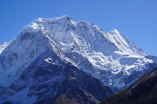
Highest peak: Pangpoche (6,620 m), also known as Panpoche I, first climbed in 2019 by a Georgian team.
Located 15 km northeast of Manaslu (8,163 m), within the Manaslu Conservation Area.
Remote and rarely ascended, offering a pristine mountaineering challenge.
-----------Geographical Features--------------
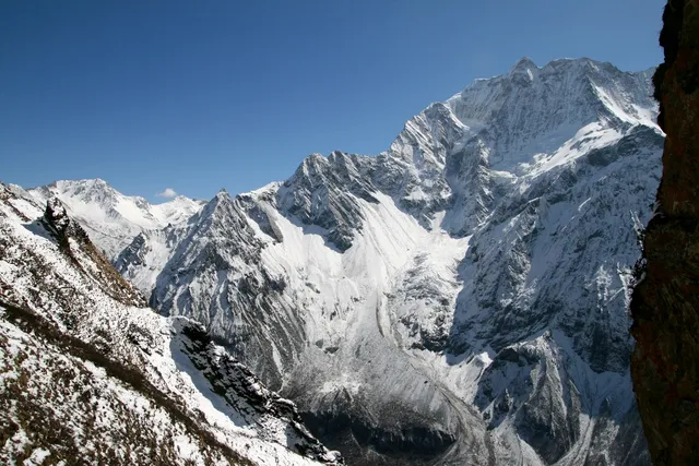
Elevation: 6,620 m; surrounding Manaslu region ranges from 1,500–8,000 m.
Features steep ridges, snowfields, and glaciers, with Pangpoche II (6,504 m) 1.5 km south.
Bordered by the Budhigandaki River valley and the Tibetan frontier to the northeast.
Rugged terrain with Rui La pass (4,998 m) as a key saddle point, requiring technical navigation.
-----------Tourism and Activities----------------
Mountaineering: Technical climbs via North-East or West-Northwest ridges, first ascended in 2019.
Trekking: Approaches via Manaslu Circuit or Samdo (10–12 days) to base camp.
Appeals to elite climbers seeking uncharted 6,000 m peaks with alpine-style challenges.
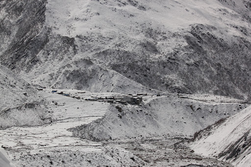
Wildlife spotting (snow leopards, blue sheep) and cultural visits to Samdo village.
---------Socio-Cultural Significance-----------
Tibetan-influenced communities in Samdo, preserving Buddhist traditions.
Cultural highlights: Ancient mani walls and chortens in Samdo village.
Tourism supports Manaslu Conservation Area and local livelihoods.
Respect sacred sites and local customs (e.g., no alcohol, clockwise circumambulation).
---------Climate Change Impact---------
Glacial retreat affects Budhigandaki River flow and climbing routes.
Warming threatens snow leopard habitats and alpine ecosystems.
Manaslu Conservation Area promotes sustainability, limited by funding.
Monsoon intensity increases landslide and avalanche risks.
--------How to Get There------------
By Air: Fly from Kathmandu to Pokhara (30 min), then to Gorkha or Arughat airstrip (if available).
By Road: Drive from Pokhara to Arughat (6–8 hrs), then trek from Soti Khola.
Trekking: Manaslu Circuit to Samdo (10–12 days), then to Pangpoche base camp.
Permits: Manaslu Conservation Area Permit (NPR 3,000 for foreigners); Restricted Area Permit...
Read more